Fenit Island facts for kids

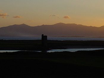
Castle on "Fenit Within"
|
|
| Geography | |
|---|---|
| Location | Tralee Bay |
| Coordinates | 52°17′N 9°52′W / 52.283°N 9.867°W |
| Administration | |
| Province | Munster |
| County | Kerry |
Fenit Island is a small island located off the coast of County Kerry, Ireland. It is a special place because it is connected to the mainland by a natural sandbar. This island sits within Tralee Bay and helps form a sheltered area called Barrow Harbour.
In the past, this area was known as 'Fenit Within'. Nearby mainland areas were called 'Tawlacht' and 'Fenit Without'. These names helped people understand which parts were protected by walls. The walls were built to keep attackers away from the land side of the island.
Contents
Getting to Fenit Island
You can reach Fenit Island in a couple of ways. Most of the time, you can walk across the sandbar that connects it to the mainland. When the tide is low, you can even drive a car onto the island by using the beach as a road. It's a unique way to visit!
Historical Buildings and Ruins
Fenit Island is home to many old ruins. These include a castle, two churches, and a graveyard. Today, the castle is the only ruin that is still clearly visible.
The FitzMaurice Castle
The castle on Fenit Island was built in the 17th century. It was constructed by a powerful family known as the FitzMaurices. This castle played an important role in protecting the island long ago.
Protecting Barrow Harbour
To keep Barrow Harbour safe from ships attacking from the sea, a large chain was used. This chain, also called a boom, was made of iron or steel. It stretched across the narrow waterway between the mainland and Fenit Island, right near the castle. This boom acted like a barrier, stopping enemy ships from entering the harbour.
Fenit Island is famous for being the birthplace of Saint Brendan the Navigator. He was an important Irish saint and explorer. Saint Brendan is known for his legendary sea voyages.
 | Emma Amos |
 | Edward Mitchell Bannister |
 | Larry D. Alexander |
 | Ernie Barnes |


