Fish Lake (Jackson County, Oregon) facts for kids
Quick facts for kids Fish Lake |
|
|---|---|

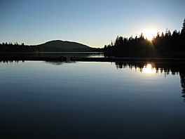
Sunset on Fish Lake
|
|
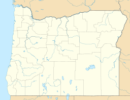
| Location | Jackson County, Oregon |
| Coordinates | 42°22′39″N 122°20′51″W / 42.37750°N 122.34750°W |
| Type | Reservoir |
| Primary inflows | Little Butte Creek watershed |
| Primary outflows | North Fork Little Butte Creek |
| Catchment area | 20 square miles (52 km2) |
| Basin countries | United States |
| Surface area | 483 acres (1,950,000 m2) |
| Average depth | 18 feet (5.5 m) |
| Max. depth | 31 feet (9.4 m) |
| Water volume | 7,836 acre-feet (9,666,000 m3) |
| Surface elevation | 4,639 feet (1,414 m) |
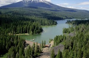
Fish Lake is a beautiful reservoir (a human-made lake) located in Jackson County, Oregon. It sits high up, about 4,639 feet (1,414 m) above sea level. You can find it about 35 miles (56 km) northeast of Medford.
Fish Lake started as a smaller, natural lake. But it was made much bigger by the 50-foot (15 m) tall Fish Lake Dam. This dam holds back the water from the north fork of Little Butte Creek. This creek is part of the larger Rogue River area.
Contents
How Fish Lake Was Formed
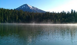
Fish Lake is surrounded by two cool volcanoes. To the north is Mount McLoughlin, and to the south is Brown Mountain.
About 2,000 years ago, lava flowed from Brown Mountain. This ancient lava now forms the southern shore of Fish Lake.
The Story of Fish Lake Dam
Fish Lake was once just a small natural lake. But in 1898, a company called the Fish Lake Water Company was created. Their goal was to help bring water to farms in the Rogue Valley.
They decided to make Fish Lake much larger. They also planned to enlarge a nearby lake called Fourmile Lake. This would allow them to store more water.
- Between 1902 and 1908, a temporary dam was built at Fish Lake.
- In 1906, the dam at Fourmile Lake was finished.
- By 1915, the two lakes were connected by the Cascade Canal. This canal brought water from Fourmile Lake over the Cascade Mountains to Fish Lake. This extra water helped fill Fish Lake even more.
- The temporary dam at Fish Lake was later replaced with a stronger, permanent earthfill dam.
- The dam was improved several times over the years. A new spillway (a channel for water to flow over) was added in 1955. Another spillway was built in 1996.
Thanks to all these changes, Fish Lake is now about three times bigger than it was naturally!
Facts and Figures

Fish Lake is quite large!
- Its average surface area is about 483 acres (1,950,000 m2).
- It holds an average of 7,836 acre-feet (9,666,000 m3) of water.
- The area that drains into the lake (its drainage basin) is about 20 square miles (52 km2).
- The lake's average depth is 18 feet (5.5 m).
- At its deepest point, it reaches 31 feet (9.4 m).
The Fish Lake Dam itself is impressive. It stands 50 feet (15 m) tall and stretches 960 feet (290 m) long.
Animals You Might See
Fish Lake is home to many cool creatures!
- In the water, you can find fish like Rainbow trout and brook trout.
- Look up in the sky, and you might spot amazing birds like Osprey and eagles flying around the lake.
Fun Things to Do
Fish Lake is a popular spot for outdoor fun!
- The famous Pacific Crest Trail (a long hiking path) goes right by the eastern side of Fish Lake.
- There are three different campgrounds around the lake where you can set up a tent.
- Many people enjoy fishing for trout in the lake.
- When the weather is warm, swimming is a favorite activity.
- You can also go boating on the lake.
 | Bayard Rustin |
 | Jeannette Carter |
 | Jeremiah A. Brown |


