
Forsayth, Queensland facts for kids
Quick facts for kids ForsaythQueensland |
|||||||||||||||
|---|---|---|---|---|---|---|---|---|---|---|---|---|---|---|---|

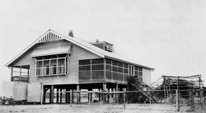
Forsayth, outback north Queensland
|
|||||||||||||||

Forsayth
Location in Queensland
|
|||||||||||||||
| Population | 107 (2021 census) | ||||||||||||||
| • Density | 0.02891/km2 (0.0749/sq mi) | ||||||||||||||
| Established | 1871 | ||||||||||||||
| Postcode(s) | 4871 | ||||||||||||||
| Area | 3,701.5 km2 (1,429.2 sq mi) | ||||||||||||||
| Time zone | AEST (UTC+10:00) | ||||||||||||||
| Location | |||||||||||||||
| LGA(s) | Shire of Etheridge | ||||||||||||||
| State electorate(s) | Traeger | ||||||||||||||
| Federal Division(s) | Kennedy | ||||||||||||||
|
|||||||||||||||
|
|||||||||||||||
Forsayth is a small town in the countryside of Queensland, Australia. It's part of the Shire of Etheridge. In 2021, about 107 people lived in Forsayth.
Contents
Exploring Forsayth's Location
Forsayth is located in Far North Queensland. It is about 415 kilometers (258 miles) by road from the city of Cairns.
The town is the final stop for the Etheridge Railway.
A Look Back at Forsayth's Past
Early Days and Gold Discovery
The area where Forsayth is now was originally home to the Jangga people. Their language, also called Yangga, is spoken in parts of Central Queensland, including the Etheridge Shire Council area.
The town started in 1871. It was first called Finnigan's Camp. This was named after a gold prospector who found gold nearby. Within a year, it grew into a township called Charleston.
Even though many people left to find gold in other places like the Palmer River Goldfield in 1874, Charleston kept growing. By the mid-1890s, it was a busy place. It had five hotels, a school, and a court.
Schools and Railways Arrive
Charleston Provisional School opened on March 4, 1895. It became Charleston State School in 1909. Later, in 1920, its name changed to Forsayth State School.
In the late 1890s, the price of metals like copper was high. New copper mines opened in the Etheridge area, including near Charleston. A company decided to build a railway line to connect these mines.
The Etheridge railway line started being built in 1907. It reached the Charleston area in January 1910. The railway ended at a new settlement across the Delaney River. This new place was first called New Charleston. It was then renamed Forsayth, after James Forsyth Thallon, who was a railway commissioner.
Moving the Town to Forsayth
After the railway arrived, all the buildings from old Charleston were moved to Forsayth. This included the police station and the school. A new post office opened in Forsayth in 1910.
New services and buildings followed. A hospital, a new court house, and a new school were built in 1912. A public hall was also built two years later.
In 1914, the local metal processing plants closed down. This meant the town became less important for mining.
Another school, Wirra Wirra Provisional School, opened in 1914. It was a simple tent school. It closed around 1918.
Later Years and Revival
Queensland Railways took over the railway line in 1918. Forsayth remained an important transport hub for the western region. There were plans to extend the railway in the 1930s, but they didn't happen.
From the 1980s, mining activity increased again. More livestock was also transported by rail. This helped the town of Forsayth become busy once more.
The Cobbold Gorge Nature Reserve was created in 2009.
Understanding Forsayth's Population
The number of people living in Forsayth has changed over the years:
- In 2006, about 101 people lived here.
- In 2011, the population was around 347 people.
- By 2016, it was about 129 people.
- In 2021, the population was 107 people.
Important Historic Places
Forsayth has some places that are listed for their historical importance:
- The Station Master's Residence, Forsayth on Fourth Street.
- The Forsayth railway station, which is part of the Etheridge railway line.
Forsayth's Local Economy
Forsayth is a center for road transport. It also serves as a hub for people visiting the area. Tourism is an important part of the local economy.
Community Facilities and Services
The Forsayth branch of the Queensland Country Women's Association has its hall on Fourth Street.
St Augustine of Canterbury Church is a church used by both Anglican and Catholic communities. It is located on the corner of Third and Fourth Streets.
Learning at Forsayth State School
Forsayth State School is a government primary school. It teaches students from early childhood up to Year 6. The school is located on Third Street. In 2018, there were 9 students enrolled at the school.
Fun Things to See and Do
The Savannahlander Train
Forsayth is a stop for a special tourist train called The Savannahlander. This train runs weekly and offers a unique way to see the area.
Exploring Cobbold Gorge
Cobbold Gorge is a large nature reserve. It covers about 4,720 hectares (18 square miles). It offers many eco-tourism experiences, like exploring the gorge and enjoying nature.
