Fort Branch, Indiana facts for kids
Quick facts for kids
Fort Branch, Indiana
|
|
|---|---|
| Town of Fort Branch | |
 |
|

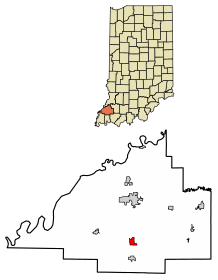
Location of Fort Branch in Gibson County, Indiana.
|
|
| Country | United States |
| State | Indiana |
| County | Gibson |
| Township | Union |
| Area | |
| • Total | 1.10 sq mi (2.85 km2) |
| • Land | 1.09 sq mi (2.82 km2) |
| • Water | 0.01 sq mi (0.03 km2) |
| Elevation | 456 ft (139 m) |
| Population
(2020)
|
|
| • Total | 2,965 |
| • Density | 2,725.18/sq mi (1,052.14/km2) |
| Time zone | UTC-6 (CST) |
| • Summer (DST) | UTC-5 (CDT) |
| ZIP code |
47648
|
| Area code(s) | 812, 930 |
| FIPS code | 18-24250 |
| GNIS feature ID | 2396941 |
| U.S. Highways | |
| Major State Roads | |
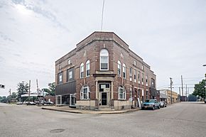
Fort Branch is a town located in Gibson County, Indiana. It is the largest town and the second biggest community in the county, right after Princeton. In 2020, the town had a population of 2,965 people. Fort Branch is considered part of the Evansville Metropolitan Area.
Contents
History of Fort Branch
Fort Branch began in 1852 when a railroad was built through the area. The town was first called LaGrange. This name came from the person who originally owned the land. However, there was already another post office in Indiana with the same name. So, the town was renamed Fort Branch. This new name honored an old fort that used to be in the area.
Tornado Events in Fort Branch
On April 3, 1989, a strong tornado passed through Fort Branch. It caused a lot of damage, estimated to be between 5 and 50 million dollars.
Another powerful tornado, an EF3, came close to the town on February 28, 2017. This tornado started in Crossville, Illinois. It passed just north of Fort Branch. Many buildings along Indiana 168 were destroyed or badly damaged by this storm.
Geography of Fort Branch
Fort Branch is located at 38°14′49″N 87°34′34″W / 38.24694°N 87.57611°W.
Based on the 2010 census, Fort Branch covers a total area of about 1.11 square miles (2.87 square kilometers). Most of this area, about 1.1 square miles (2.85 square kilometers), is land. Only a small part, about 0.01 square miles (0.03 square kilometers), is water.
Population and People
| Historical population | |||
|---|---|---|---|
| Census | Pop. | %± | |
| 1880 | 778 | — | |
| 1890 | 748 | −3.9% | |
| 1900 | 849 | 13.5% | |
| 1910 | 1,182 | 39.2% | |
| 1920 | 1,389 | 17.5% | |
| 1930 | 1,341 | −3.5% | |
| 1940 | 1,552 | 15.7% | |
| 1950 | 1,944 | 25.3% | |
| 1960 | 1,983 | 2.0% | |
| 1970 | 2,535 | 27.8% | |
| 1980 | 2,504 | −1.2% | |
| 1990 | 2,447 | −2.3% | |
| 2000 | 2,320 | −5.2% | |
| 2010 | 2,771 | 19.4% | |
| 2020 | 2,965 | 7.0% | |
| U.S. Decennial Census | |||
Fort Branch Population in 2010
In 2010, the town of Fort Branch had 2,771 residents. There were 1,162 households and 774 families living there. The town had about 2,519 people per square mile. There were also 1,244 housing units.
About 31.7% of households had children under 18 years old. Many households, 51.3%, were married couples living together. About 29.3% of all households were made up of individuals living alone. About 10.7% of these individuals were 65 years or older. The average household had 2.38 people.
The average age of people in Fort Branch was 38 years old. About 24.4% of residents were under 18. About 14.4% were 65 years or older. The population was almost evenly split between males (49.8%) and females (50.2%).
Education in Fort Branch
Fort Branch is part of the South Gibson School Corporation.
Local Schools
- K-8: Fort Branch Community School
- 9-12: Gibson Southern High School
Higher Education
- College: Vincennes University Center for Advanced Manufacturing
Past Schools
- Fort Branch High School (This school joined with Gibson Southern High School in 1974.)
- Marlette School
Public Library Services
Fort Branch has a public library. It is a part of the Fort Branch-Johnson Township Public Library system. This library provides books and resources for the community.
Economy and Jobs
Like the nearby town of Princeton, Fort Branch has many jobs in industries that involve physical labor. For a long time, the biggest employer in town was the Emge Foods processing and packing plant. This plant was located on the southwest side of town. It had been running for almost 90 years when it closed in May 1999.

Toyota Plant's Impact
As the Emge plant was closing, Toyota announced plans to build a large manufacturing factory. This factory was built on farmland between Fort Branch and Princeton. Many new employees moved to Fort Branch, Haubstadt, or Owensville to be closer to their jobs at the new Toyota plant.
New Education Facility
Recently, Vincennes University decided to build a new education center. This center focuses on advanced manufacturing. It is located just south of Fort Branch, along U.S. 41. The goal is to teach new manufacturing methods to people in the area. This new facility is expected to greatly improve life in the Fort Branch-Haubstadt area. Construction started on October 23, 2009, and the facility opened in August 2011.
Emge Plant Fire
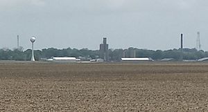
On June 18, 2010, a fire broke out at the old Emge Foods plant. By June 22, the fire had destroyed the empty meat processing part of the complex. Firefighters from three counties worked to put out the fire. They faced challenges like the old building's unstable structure and very hot temperatures. As of February 2014, only the smokestack of the plant remained. The rest of the building and the original water tower were torn down between September 2013 and January 2014. There are no known plans for what will happen with the property in the future.
Panorama
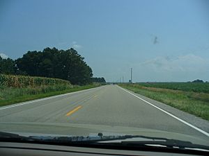
Major Highways
See also
 In Spanish: Fort Branch (Indiana) para niños
 | Isaac Myers |
 | D. Hamilton Jackson |
 | A. Philip Randolph |


