
Crossville, Illinois facts for kids
Quick facts for kids
Crossville
|
|
|---|---|

Jacobs Park
|
|

Location of Crossville in White County, Illinois.
|
|
.svg)
Location of Illinois in the United States
|
|
| Country | United States |
| State | Illinois |
| County | White |
| Area | |
| • Total | 0.64 sq mi (1.66 km2) |
| • Land | 0.64 sq mi (1.66 km2) |
| • Water | 0.00 sq mi (0.00 km2) |
| Elevation | 397 ft (121 m) |
| Population
(2020)
|
|
| • Total | 623 |
| • Density | 973.44/sq mi (375.57/km2) |
| Time zone | UTC-6 (CST) |
| • Summer (DST) | UTC-5 (CDT) |
| ZIP Code(s) |
62827
|
| Area code(s) | 618 |
| FIPS code | 17-17783 |
| GNIS ID | 2398655 |
| Wikimedia Commons | Crossville, Illinois |
Crossville is a small village located in White County, Illinois, in the United States. It's a quiet place with a friendly community. In 2020, about 623 people lived here.
Contents
History of Crossville
Crossville was planned out in 1872 by a surveyor named John Mills. He did this for two people, Thomas Cross and Silas Elliott. The village was named after Thomas Cross. The original area of the town was about half a mile square.
The Railroad's Role in Founding Crossville
The village of Crossville grew because of the Cairo and Vincennes Railroad. This railroad opened on December 9, 1872. Before that, there were plans for a railroad in the area as early as 1853. However, those plans didn't work out.
Later, in 1857, another company tried to build a railroad. They first thought about going through a town called Phillipstown. But the landowners there didn't want to give up their land for the railroad.
Instead, Thomas Cross, who the town is named after, gave land for the railroad in 1857. This land was right in the middle of where Crossville would later be. The railroad project paused during the American Civil War. But by 1867, work on the railroad started again in a big way.
When Crossville Became a Village
Crossville officially became a village on September 30, 1895. The official paperwork for the town was completed on October 12, 1895.
2017 Tornado Event
On February 28, 2017, a strong tornado hit Crossville. It was an EF3 tornado, which means it caused a lot of damage. Sadly, one person passed away during this event.
Geography of Crossville
Crossville is located at 38°9′47″N 88°4′0″W / 38.16306°N 88.06667°W. You can find the village where two main roads, Illinois State Route 1 and Illinois State Route 14, meet. It is northeast of Carmi. The village is also just a few miles west of the Illinois-Indiana state line, near the Wabash River.
According to the 2010 census, Crossville covers an area of about 0.64 square miles (1.66 km2). All of this area is land, with no large bodies of water inside the village limits.
Population Information
| Historical population | |||
|---|---|---|---|
| Census | Pop. | %± | |
| 1880 | 162 | — | |
| 1900 | 523 | — | |
| 1910 | 574 | 9.8% | |
| 1920 | 558 | −2.8% | |
| 1930 | 508 | −9.0% | |
| 1940 | 666 | 31.1% | |
| 1950 | 866 | 30.0% | |
| 1960 | 874 | 0.9% | |
| 1970 | 860 | −1.6% | |
| 1980 | 944 | 9.8% | |
| 1990 | 805 | −14.7% | |
| 2000 | 782 | −2.9% | |
| 2010 | 745 | −4.7% | |
| 2020 | 623 | −16.4% | |
| U.S. Decennial Census | |||
As of the census in 2000, there were 782 people living in Crossville. These people made up 341 households. About 220 of these were families. The village had about 1,217.1 inhabitants per square mile (469.9/km2) people per square mile.
Most of the people in Crossville were White (97.70%). A small number were Native American (1.15%). Some people were from two or more races (1.15%). About 1.02% of the population identified as Hispanic or Latino.
Age and Households
In 2000, about 29.9% of households had children under 18 living with them. More than half (51.9%) were married couples. About 31.1% of households were individuals living alone. This included 18.2% of people who were 65 years or older.
The population was spread out by age. About 24.3% were under 18 years old. About 19.4% were 65 years or older. The average age in the village was 40 years.
Education in Crossville
Crossville is part of the Carmi-White County Community Unit School District 5. Students in the village attend schools within this district. The main high school for the area is Carmi-White County High School.
Images for kids
-
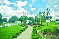
Jacobs Park, a local park in Crossville.
-

Map showing Crossville's location in White County, Illinois.
-
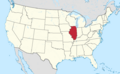
Map showing the location of Illinois within the United States.
See also
 In Spanish: Crossville (Illinois) para niños
