Fort Regent facts for kids
Quick facts for kids Fort Regent |
|
|---|---|
| Saint Helier, Jersey | |
Fort Regent in 2008.
|
|
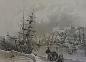
Fort Regent in the 19th century.
|
|
| Coordinates | 49°10′53″N 2°06′21″W / 49.1813°N 2.1059°W |
| Type | Fortification |
| Site information | |
| Owner | People of Jersey |
| Controlled by | States of Jersey |
| Open to the public |
Yes |
| Condition | Intact |
| Site history | |
| Built | 1806 to 1814 |
| Materials | Granite Carboniferous limestone |
| Garrison information | |
| Garrison | British Army Jersey Militia Wehrmacht (1940–1945) |
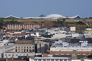
Fort Regent is a large fort built in the 1800s. It sits on top of a hill called Mont de la Ville, or Town Hill, in St. Helier, Jersey. Today, it is also a popular leisure centre.
The fort is close to other military buildings at La Collette. It looks out over the old Elizabeth Castle and the busy harbour. Fort Regent has strong walls, deep ditches, and special areas for cannons. In the middle, there was once a parade ground for soldiers. This area is now covered by a roof and used for activities.
Contents
Ancient History of Town Hill
Long before Fort Regent was built, an ancient stone monument called a dolmen stood on Town Hill. People discovered this dolmen in 1785 while clearing land for a parade ground.
The dolmen was given to Henry Seymour Conway, who was the Governor of Jersey at the time. He moved it to his home in England in 1788.
Early Plans for Fortifying the Hill
During the Middle Ages, Town Hill was open land for everyone to use. A small chapel was at the bottom of the hill, but it was removed in 1814.
In 1550, King Edward VI thought about moving the town onto the hill. He believed it would be easier to defend there. However, the town never moved.
Later, in 1591, Queen Elizabeth I also wanted to build defenses on the hill. She promised to protect the town from attacks. But there is no proof that any building work happened then.
17th Century Conflicts
In October 1651, during a war in England, a Parliamentarian army attacked Elizabeth Castle. They used large cannons called mortars from Town Hill. These cannons fired explosive shells at the castle. This attack eventually made the castle surrender in December 1651.
18th Century Defenses
Early drawings from 1757 show the first signs of defenses on Town Hill. These were likely simple earthworks, not strong stone walls. Maps from the late 1700s also suggest these early defenses.
In 1781, during the Battle of Jersey, soldiers used Town Hill. They positioned themselves there to stop the invading French army from escaping.
Building Fort Regent in the 1800s
The construction of the fort we see today began on November 7, 1806. This was during the Napoleonic Wars. George Don, the Lieutenant Governor of Jersey, laid the first stone.
About 800 workers, including local people and Royal Engineers, built the fort. They worked hard, and much of the fort was finished by 1814.
The fort was named Fort Regent to honor Prince Regent. He was the King of the United Kingdom at that time.
Fort Walls and Defenses
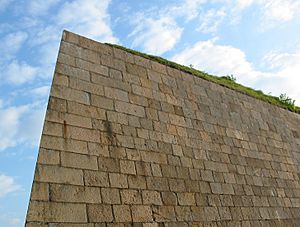
The fort has very thick walls, especially on the west side. These walls are about 5.5 meters (18 feet) thick. They protected the fort from attacks from the cliffs below. The cliffs were also made steeper by quarrying.
On the east side, a similar strong wall protects the fort. From this wall, you can see the southeast coast of Jersey. You can even spot Icho Tower, another old defense tower.
Bastions, Redans, and Ditches
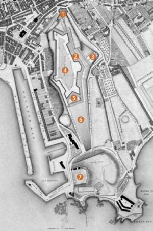
Fort Regent has two main strong points called bastions, one facing west and one east. It also has four redans, which are like smaller bastions. Cannons placed in these areas could fire in almost any direction. This protected the fort from all sides.
At the south end of the fort is a large, flat, grassy slope called a glacis. It is about 210 meters (689 feet) long. This area is the only easy way to get into the fort by road or on foot. All other sides have very steep cliffs.
The East Ditch has strong stone walls. There is also a deeper outer ditch. In 1873, the Jersey Eastern Railway made this cutting even bigger to use it as a train station.
Fort Regent Cannons
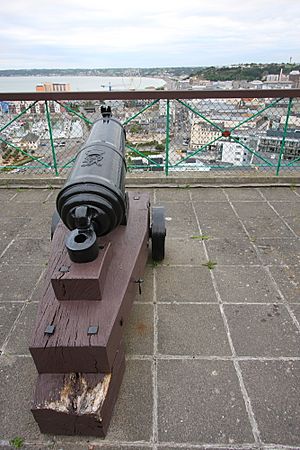
The fort was designed to hold 100 cannons. However, a report from 1810 shows that it had 55 cannons and six mortars at that time.
The Deep Well
There was no water on Town Hill, so workers dug a very deep well. Between 1806 and 1808, they blasted through 71 meters (235 feet) of hard Jersey granite. They used gunpowder to create a shaft about 2.4 meters (8 feet) wide. This well is thought to be the deepest on the island.
When the workers finally hit a spring, water rushed in quickly. The engineers in charge had to work fast to get the miners out of the shaft before they drowned.
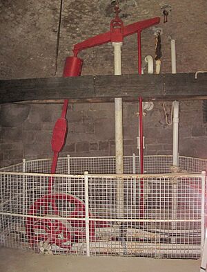
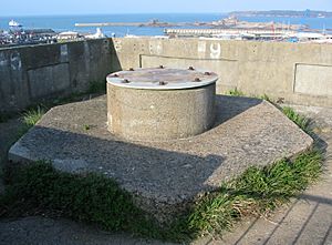
Over the years, different ways were used to bring water up. First, horses powered a machine. Then, a man-powered capstan was installed by Henry Maudslay and Son in 1815. Later, donkeys, a steam engine, and then a gas engine were used. The original 1815 well-head machinery and the old gas engine are still there today.
During the fort's conversion into a leisure centre in the 1970s, some old parts of the well machinery were removed. Today, accessing the underground well chambers is considered too dangerous for the public.
An interesting discovery was made in 1979 while cleaning the well shaft. Workers found a very hot granite surface about 30 meters (100 feet) down. Water dripping on it turned to steam. This might be a rare example of geothermal heat on the island.
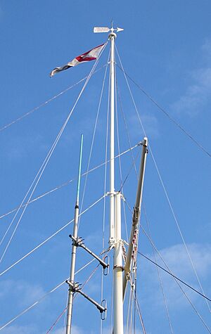
Signal Station History
Town Hill has been used as a place to send signals since the late 1700s. This was even before Fort Regent was built.
Fort Regent in the 20th Century
The last British soldiers to guard Fort Regent were from the Royal Militia of the Island of Jersey. They left the fort on June 20, 1940.
German Occupation
During World War II, German forces took over the fort. They added new structures, including platforms for anti-aircraft cannons. Some of these concrete structures can still be seen today.
Post-War Storage
After the war, Fort Regent was used for storage. It held potatoes, wine, and coal. The nearby power station used coal at that time.
Becoming a Leisure Centre
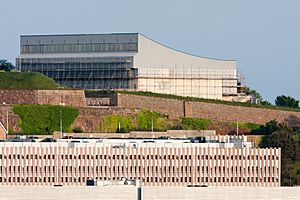
In December 1967, the States of Jersey decided to turn the fort into a leisure centre. The first new addition was a swimming pool, which opened in 1971. This pool closed in 2009, and its roof was removed in early 2021.
Recent Changes and Future Plans
In 2021, the Government of Jersey released a report called Inspiring Active Places Strategy. This plan suggested moving sports facilities out of Fort Regent. The report stated that the fort was no longer the best place for health and fitness activities for St. Helier residents.
By early 2022, many sports facilities were moved from Fort Regent. New leisure centres and sports areas have been built or are being planned in other locations around Jersey.
See also
- Mont Orgueil
- Mount Bingham
 | Victor J. Glover |
 | Yvonne Cagle |
 | Jeanette Epps |
 | Bernard A. Harris Jr. |


