Fort Thompson Mounds facts for kids
|
Fort Thompson Mounds
|
|

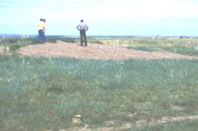
One of the mounds
|
|
| Nearest city | Fort Thompson, South Dakota |
|---|---|
| Area | 19.1 acres (7.7 ha) |
| NRHP reference No. | 66000711 |
Quick facts for kids Significant dates |
|
| Added to NRHP | October 15, 1966 |
| Designated NHLD | July 19, 1964 |
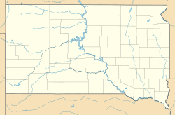
The Fort Thompson Mounds are a group of very old archaeological sites. You can find them in Buffalo County, South Dakota, close to the town of Fort Thompson. These mounds are part of the Crow Creek Reservation.
In 1964, the US Department of Interior named this area a National Historic Landmark. This means it's a very important historical place. The mounds stretch for about 6 miles (9.7 km) along the east side of the Missouri River. It's one of the biggest groups of burial mounds in the Plains region, north of Kansas.
Archaeologists dug up one of the sites in the 1950s. They found that people lived there nearly 5,000 years ago, around 2450 BCE. Experts believe the mounds themselves were built later, starting around 800 CE, during a time called the Plains-Woodland period.
What Are the Fort Thompson Mounds?
The Fort Thompson Mounds are low, rounded hills made of earth. They run along the eastern bank of the Missouri River. You can find them past Fort Thompson and the Big Bend Dam. These mounds are usually on a flat area above the river, about 50 feet (15 m) higher than the water level was in the early 1960s.
Scientists think all of these mounds were used as burial sites. Sometimes, these burial mounds were built on top of even older human settlements. Most of the mounds date back to the Plains-Woodland period, around 800 CE. Evidence found here shows that these were the first people in the area to make pottery.
Discovering the Mounds
People knew about these sites for a long time, but they weren't fully studied until the 1950s. At that time, the United States Army Corps of Engineers started planning to build the Big Bend Dam. This dam was part of a big project to control floods on the Missouri River.
Starting in 1957, archaeologists began digging at the sites. They wanted to learn more about them. They also needed to save important historical items before the dam's water covered the area. This process is called salvage archaeology.
Besides burials, archaeologists also found signs of where people lived. These included stone fire pits (hearths), pieces of pottery, and stone tools. One of the sites they dug up showed dates from around 2450 BCE. This proves that people lived in this area for a very long time.
See also
 | Emma Amos |
 | Edward Mitchell Bannister |
 | Larry D. Alexander |
 | Ernie Barnes |


