
List of National Historic Landmarks in South Dakota facts for kids
South Dakota is home to many important places that tell us about the past! These special spots are called National Historic Landmarks (NHLs). They are chosen by the U.S. Federal Government because they are super important to the history of the United States.
There are 16 National Historic Landmarks in South Dakota. One of these is also partly in Iowa. These landmarks are found in 13 of South Dakota's 66 counties. Many of them are located near rivers, which were important places for people to live long ago.
Contents
South Dakota's Special Historic Places
South Dakota has many amazing places that are recognized as National Historic Landmarks. These sites help us learn about ancient cultures, important events, and how people lived long ago.
Ancient Villages and Sites
Many landmarks in South Dakota are places where ancient people lived. These archaeological sites help us understand early Native American life.
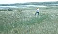
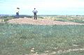
Arzberger Site
The Arzberger site, chosen in 1964, is near Pierre in Hughes County. It's an archaeological site of a fortified Native American village from the 15th century. Experts believe it was home to the Arikara people.
Bloom Site
The Bloom Site, also designated in 1964, is located near Bloom in Hanson County. This fortified archaeological site has remains of about 25 rectangular houses from around 1000 CE. It also had burial mounds, which were later removed. This site might have been used by ancestors of the Mandan people.
Blood Run Site
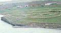
The Blood Run Site, named a landmark in 1970, stretches across Shindler, South Dakota and Granite, Iowa. It's an important Native American archaeological site that goes into Iowa. It shows how people lived and traded long ago in this region.
Crow Creek Site
The Crow Creek Site, recognized in 1964, is near Chamberlain in Buffalo County. This site is known for a sad event that happened around 1325. It helps us learn about the challenges faced by Native American communities in the past.
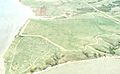
Fort Thompson Mounds
The Fort Thompson Mounds, designated in 1964, are located near Fort Thompson in Buffalo County. This area has many ancient burial mounds along the Missouri River. They are important for understanding ancient burial practices.
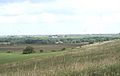
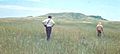
Langdeau Site
The Langdeau Site, chosen in 1964, is near Lower Brule in Lyman County. This is another important archaeological site that helps us learn about early cultures in the area.
Mitchell Site
The Mitchell Site, designated in 1964, is in Mitchell in Davison County. This archaeological site shows us a prehistoric village from the Mississippian culture. It is open to the public, so you can visit and learn more!
Molstad Village
Molstad Village, recognized in 1964, is near Mobridge in Dewey County. This fortified prehistoric village has five circular house rings surrounded by a ditch. It shows a time when the Mandan, Hidatsa, and Arikara peoples were developing their unique cultures.
Vanderbilt Archeological Site
The Vanderbilt Archeological Site, designated in 1997, is near Pollock in Campbell County. This site provides more clues about ancient life in South Dakota.
Verendrye Site
The Verendrye Site, chosen in 1991, is near Fort Pierre in Stanley County. This site is important for understanding early exploration and Native American history in the region.
Historic Towns and Landmarks
Some landmarks are entire towns or important buildings that played a big role in South Dakota's history.
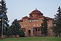
Battle Mountain Sanitarium
The Battle Mountain Sanitarium, named a landmark in 2011, is in Hot Springs in Fall River County. This building was built in 1907 to help veterans who were sick.
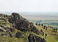
Bear Butte
Bear Butte, recognized in 1981, is near Sturgis in Meade County. It is a very important place for many Native American tribes, used for ceremonies and spiritual practices.
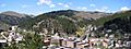
Deadwood Historic District
The Deadwood Historic District, designated in 1961, is the historic mining town of Deadwood in Lawrence County. This town is famous for its gold rush history and Wild West stories.
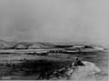
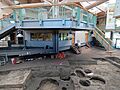
Fort Pierre Chouteau Site
The Fort Pierre Chouteau Site, chosen in 1991, is near Fort Pierre in Stanley County. This site was once a very important trading post.
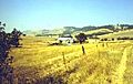
Frawley Ranch
Frawley Ranch, named a landmark in 1977, is near Spearfish in Lawrence County. This ranch is a great example of a historic working ranch.
Wounded Knee National Historic Landmark
The Wounded Knee National Historic Landmark, designated in 1965, is on the Pine Ridge Indian Reservation in Oglala Lakota County. This site marks a very sad and important event in Native American history.
Other Important National Historic Areas
Besides the National Historic Landmarks, South Dakota also has other special places that are part of the United States National Park System. These places are already highly protected because they are so important to our nation's history.
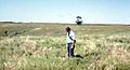
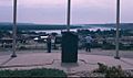
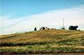
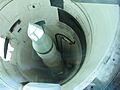
Minuteman Missile National Historic Site
This site was established in 1999 and is located in Jackson and Pennington counties. It helps us learn about the Cold War and the history of nuclear missiles.
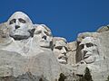
Mount Rushmore National Memorial
Mount Rushmore was established in 1925 in the Black Hills of Pennington County. It is a famous monument with the faces of four U.S. presidents carved into the mountain.
Images for kids
-
Arzberger Site
-
Battle Mountain Sanitarium
-
Bear Butte
-
Blood Run Site
-
Bloom Site
-
Crow Creek Site
-
Deadwood Historic District
-
Fort Pierre Chouteau
-
Fort Thompson Mounds
-
Frawley Ranch
-
Langdeau Site
-
Mitchell Site
-
Molstad Village
-
Verendrye Site
-
Wounded Knee National Historic Landmark
-
Minuteman Missile National Historic Site
-
Mount Rushmore National Memorial


See also
