Campbell County, South Dakota facts for kids
Quick facts for kids
Campbell County
|
|
|---|---|
 |
|

Location within the U.S. state of South Dakota
|
|
 South Dakota's location within the U.S. |
|
| Country | |
| State | |
| Founded | 1873 (created) 1884 (organized) |
| Seat | Mound City |
| Largest city | Herreid |
| Area | |
| • Total | 771 sq mi (2,000 km2) |
| • Land | 734 sq mi (1,900 km2) |
| • Water | 37 sq mi (100 km2) 4.8% |
| Population
(2020)
|
|
| • Total | 1,377 |
| • Estimate
(2023)
|
1,340 |
| • Density | 1.7860/sq mi (0.6896/km2) |
| Time zone | UTC−6 (Central) |
| • Summer (DST) | UTC−5 (CDT) |
| Congressional district | At-large |
Campbell County is a county in the U.S. state of South Dakota. In 2020, about 1,377 people lived there. This makes it one of the least populated counties in South Dakota.
The main town, or county seat, is Mound City. The county was first set up in 1873 and officially started working in 1884. It was named after Norman B. Campbell. He was a lawmaker in the Dakota Territory back in 1873.
Contents
History of Campbell County
Campbell County was officially created in 1873. It was fully organized in 1884. The first county seat was a place called La Grace. But in 1888, the county seat moved to Mound City.
By 1911, some towns grew bigger. These included Artas, Herreid, and Pollock. They grew because they were located along a train line. This line was part of the Soo Line.
Geography of Campbell County
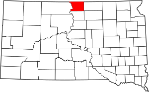
Campbell County is in the northern part of South Dakota. Its northern border touches the state of North Dakota. The Missouri River flows along the county's western edge.
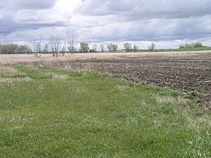
The land here has low, rolling hills. Some parts are used for farming. The highest point in the county is about 2,060 feet (628 meters) high. It is located near the northeast corner.
The county covers about 771 square miles (1,997 square kilometers). Most of this is land, about 734 square miles (1,901 square kilometers). The rest, about 37 square miles (96 square kilometers), is water.
Campbell County is in the Central Time Zone. This is different from some western counties in South Dakota.
Main Roads
 U.S. Highway 83
 South Dakota Highway 10
 South Dakota Highway 271
 South Dakota Highway 1804
Neighboring Counties
- Emmons County, North Dakota - to the north
- McIntosh County, North Dakota - to the northeast
- McPherson County - to the east
- Walworth County - to the south
- Corson County - to the west (this county is in the Mountain Time Zone)
Special Areas
- Pocasse National Wildlife Refuge
- Rogo Bay State Game Production Area
- Salt Lake State Game Production Area
- Sand Lake State Game Production Area
- Shaw Creek State Lakeside Use Area
- West Pollock State Recreation Area
Lakes in the County
- McClarem Lake
- Lake Oahe (a part of it)
- Lake Pocasse
- Salt Lake
- Sand Lake
People in Campbell County
| Historical population | |||
|---|---|---|---|
| Census | Pop. | %± | |
| 1880 | 50 | — | |
| 1890 | 3,510 | 6,920.0% | |
| 1900 | 4,527 | 29.0% | |
| 1910 | 5,244 | 15.8% | |
| 1920 | 5,305 | 1.2% | |
| 1930 | 5,629 | 6.1% | |
| 1940 | 5,033 | −10.6% | |
| 1950 | 4,046 | −19.6% | |
| 1960 | 3,531 | −12.7% | |
| 1970 | 2,866 | −18.8% | |
| 1980 | 2,243 | −21.7% | |
| 1990 | 1,965 | −12.4% | |
| 2000 | 1,782 | −9.3% | |
| 2010 | 1,466 | −17.7% | |
| 2020 | 1,377 | −6.1% | |
| 2023 (est.) | 1,340 | −8.6% | |
| U.S. Decennial Census 1790-1960 1900-1990 1990-2000 2010-2020 |
|||
In 2020, the county had 1,377 people living there. There were 640 households. The population density was about 1.9 people per square mile.
Most people in Campbell County are white. A small number are of Hispanic or Latino background. Many people have German, Norwegian, or Dutch family roots. The average age of people living here is about 50 years old.
Religion
Many people in Campbell County belong to Christian churches. The largest groups include the Evangelical Lutheran Church in America and the Catholic Church. The Presbyterian Church in America also has many members. Campbell County has the highest percentage of Presbyterians in the United States.
Towns and Communities
Campbell County does not have official townships. However, some areas are named like Artas Township and Mound City Township.
City
Towns
- Artas
- Mound City (This is the county seat)
- Pollock
Other Communities
These are smaller places that are not officially towns:
- Gale
- La Grace (This is a ghost town and was once the county seat)
- North Campbell
- South Campbell
- Tilso
- Vanderbilt (This is also a ghost town)
See also
 In Spanish: Condado de Campbell (Dakota del Sur) para niños
 | Precious Adams |
 | Lauren Anderson |
 | Janet Collins |

