Fortescue River facts for kids
Quick facts for kids Fortescue River |
|
|---|---|

Ophthalmia Dam, Fortescue River
|
|
| Country | Australia |
| Physical characteristics | |
| Main source | Ophthalmia Range 602 metres (1,975 ft) |
| River mouth | Indian Ocean |
| Length | 760 kilometres (472 mi) |
| Basin features | |
| Basin size | 49,759 square kilometres (19,212 sq mi) |

The Fortescue River is a special river in the Pilbara region of Western Australia. It's known as an ephemeral river, which means it doesn't always have water flowing in it. Instead, it often has dry sections or just a few permanent waterholes. It is the third longest river in the state.
Contents
Journey of the Fortescue River
The Fortescue River starts near Deadman Hill in the Ophthalmia Range. This is about 30 kilometers (19 miles) south of the town of Newman.
It flows north, running alongside the Great Northern Highway. It crosses this highway near the turn-off for Marble Bar. The river then turns to flow north-west and then west. It crosses the Great Northern Highway again, this time north of the Auski Roadhouse.
About 100 kilometers (62 miles) north of Newman, the river flows through a huge wetland called the Fortescue Marsh. This marsh covers about 960 square kilometers (370 square miles) and is a very important natural area. The river keeps heading west, crossing Highway 1 at the Fortescue Roadhouse. Finally, it empties into the Indian Ocean at Mardie Station, which is about 40 kilometers (25 miles) south-west of Dampier.
Smaller Rivers Joining In
The Fortescue River has 24 smaller rivers and creeks that flow into it. These are called tributaries. Some of the main ones include Western Creek, Warrawanda Creek, Shovelanna Creek, Kalgan Creek, and Cowcumba Creek.
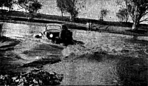
During a big storm called Cyclone Joan in 1975, many of these tributaries flooded. Weeli Wolli Creek and Weelumurra Creek overflowed. This caused floods and damaged the railway lines used by mining companies like Hamersley Iron and Mount Newman.
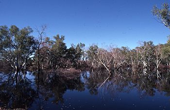
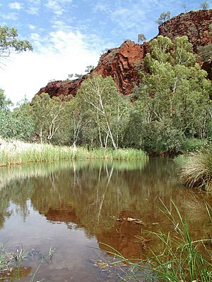
Even when the river isn't flowing, it has several permanent waterholes. These include Tarda Pool, Mungowarra Pool, Crossing Pool, and Deep Reach Pool. These pools are important for wildlife.
The River's Home: Its Catchment Area
The Fortescue River's catchment area is the land where all the rain collects and flows into the river. This area drains water from the southern side of the Chichester Plateau and the northern side of the Hamersley Range. The river flows through the valley between these two ranges.
The land in this valley is mostly made of earthy clays. You can also find cracking clays, loams, and hard red soils here.
Water from the river is stored at Ophthalmia Dam. This dam can hold 32,000 megaliters of water. About 6,290 megaliters of water are taken from the dam each year to supply the town of Newman.
Fortescue Marshes: A Special Wetland
The area where the Fortescue River begins is flat and marshy. This is where Western Creek, Warrawanda Creek, and the Fortescue River all meet.
After this marshy area, the river flows through a less defined channel until it reaches Gregory Gorge. From there, the river forms a clear channel. It then flows through several pools before reaching the area where it meets the ocean.
Where the River Meets the Ocean
The mouth of the Fortescue River is a large estuary. An estuary is where a river meets the sea, and fresh water mixes with salt water. This estuary is mostly natural and works mainly because of the river's energy. The land formed by the river at its mouth is shaped by the ocean's tides.
The estuary covers a total area of about 23.3 square kilometers (9 square miles). Most of this area is made up of salt marsh and flat areas that are covered and uncovered by the tides. A group of mangrove trees also lives in the estuary, covering about 1.2 square kilometers (0.5 square miles). Large female Barramundi fish are known to live in this estuary.
A Look Back in Time
The Fortescue River was named in 1861 by an explorer and surveyor named Francis Thomas Gregory. He named it after Chichester Fortescue, who was an important government official in charge of the colonies at the time.
The traditional owners of the land where the river flows are the Yindjibarndi peoples. They have lived in this area for thousands of years.
Mardie Station, located at the western end of the river, was set up before 1883. By that year, it had fences around three areas and was home to about 18,000 sheep.
Roy Hill Station, which is much further inland, was settled in 1886 by Nat Cooke. The first official lease for this land was given to D. MacKay in 1890.
In the late 1920s, a 69-meter (226-foot) bridge was built over the river near Roy Hill. This bridge helped the cattle industry move their animals across the river.
Future Plans for the River
People have studied the Fortescue River to see if it would be a good place to build dams. Possible locations for dams include Gregory Gorge, Dogger Gorge, and Ophthalmia.
 | Lonnie Johnson |
 | Granville Woods |
 | Lewis Howard Latimer |
 | James West |


