Francis Peak facts for kids
Quick facts for kids Francis Peak |
|
|---|---|
| Highest point | |
| Elevation | 9524+ ft (2903+ m) NAVD 88 |
| Prominence | 500 feet (152 m) |
| Geography | |
| Location | Davis County, Utah, U.S. |
| Parent range | Wasatch Range |
| Topo map | USGS Peterson |
Francis Peak is a tall mountain in the Wasatch Range in Utah, United States. It stands at about 9,560 feet (2,910 m) high. This peak was named after Esther Charlotte Emily Weisbrodt Francis. She was an early pioneer who helped settle the Morgan Valley area in Morgan County, Utah.
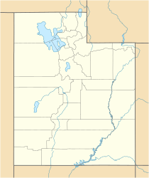
Francis Peak is located right on the border between Morgan and Davis counties. It's about 18 miles (29 km) north of Salt Lake City. This makes it a great spot for people living nearby to visit.
You can reach the top of Francis Peak in many ways. You can hike, bike, or even drive there. Roads like Skyline Drive in Bountiful and Farmington Canyon Road in Farmington lead to the peak. When you visit, you'll find places to camp, trails for exploring, small ponds, and lots of wildlife. The views from the top are amazing!
How Tall is Francis Peak?
The exact height of Francis Peak has been a topic of discussion. The U.S. Geological Survey once listed its height as 9,547 feet above sea level. However, things changed after the 1950s.
Radar Domes and New Height
In the 1950s, two large radar domes were built on top of the peak. These domes are used for important tracking purposes. Because of this construction, the natural height of the mountain is now considered to be 9,515 feet.
The base of the radar facility adds another 55 feet to the height. The domes themselves add 60 feet more. This means the artificial structures add a total of 115 feet to the mountain. So, the total height of Francis Peak, including the radar facility, is now about 9,630 feet above sea level.
 | Lonnie Johnson |
 | Granville Woods |
 | Lewis Howard Latimer |
 | James West |


