Freetown, Indiana facts for kids
Quick facts for kids
Freetown, Indiana
|
|
|---|---|

Freetown, Indiana
|
|

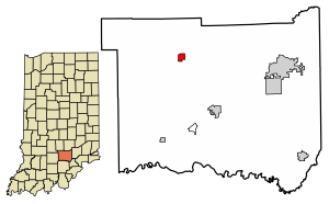
Location of Freetown in Jackson County, Indiana
|
|
| Country | United States |
| State | Indiana |
| County | Jackson |
| Township | Pershing |
| Area | |
| • Total | 0.69 sq mi (1.80 km2) |
| • Land | 0.69 sq mi (1.79 km2) |
| • Water | 0.00 sq mi (0.00 km2) |
| Elevation | 659 ft (201 m) |
| Population
(2020)
|
|
| • Total | 369 |
| • Density | 532.47/sq mi (205.65/km2) |
| ZIP code |
47235
|
| FIPS code | 18-25864 |
| GNIS feature ID | 2629879 |
Freetown is a small community located in Pershing Township, Jackson County, Indiana, in the United States. It is known as a "census-designated place" (CDP). This means it's an area that the government identifies for collecting statistics, even though it doesn't have its own official city or town government. In 2020, about 369 people called Freetown home.
Contents
A Look Back: Freetown's History
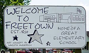
Freetown was officially planned and marked out in 1850. This process is called "platting," where land is divided into lots and streets. In the same year, a post office was opened in Freetown, making it easier for people to send and receive mail.
A special building in Freetown, the Frank Wheeler Hotel, was recognized for its historical importance in 1991. It was added to the National Register of Historic Places, which is a list of places in the United States that are worth preserving because of their history.
Exploring Freetown's Geography
Freetown is located in the northwestern part of Jackson County. On its western side, it borders the large Hoosier National Forest, a beautiful area with lots of trees and nature.
Two main roads pass through or near Freetown. Indiana State Road 135 runs through the western part of the community. If you travel north on this road for about 18 miles (29 km), you'll reach Gnaw Bone. Going south for about 11 miles (18 km) will take you to Brownstown, which is the main town and county seat of Jackson County.
State Road 58 goes through the western and northern sides of Freetown. Heading northeast on this road for about 23 miles (37 km) leads to Columbus. If you go southwest for about 27 miles (43 km), you'll arrive in Bedford.
The total area of the Freetown census-designated place is about 0.69 square miles (1.8 square kilometers). A very small part of this area, about 0.42%, is water.
Who Lives in Freetown: Demographics
| Historical population | |||
|---|---|---|---|
| Census | Pop. | %± | |
| 2020 | 369 | — | |
| U.S. Decennial Census | |||
The population of Freetown changes over time. According to the 2020 census, there were 369 people living in Freetown. This number helps us understand how many people reside in the community at a specific time.
See also
 In Spanish: Freetown (Indiana) para niños
 | Shirley Ann Jackson |
 | Garett Morgan |
 | J. Ernest Wilkins Jr. |
 | Elijah McCoy |


