Freeville, New York facts for kids
Quick facts for kids
Freeville, New York
|
|
|---|---|
|
Village
|
|

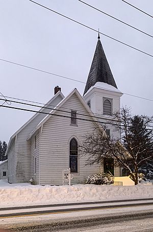
Freeville United Methodist Church
|
|
| Country | United States |
| State | New York |
| County | Tompkins |
| Settled | circa 1798 |
| Incorporated | July 2, 1887 |
| Named for | Uncertain, possibly suggested by first settler as an alternative to the name "White's Mill," which referred to him and his property |
| Area | |
| • Total | 1.09 sq mi (2.84 km2) |
| • Land | 1.06 sq mi (2.74 km2) |
| • Water | 0.04 sq mi (0.10 km2) |
| Elevation | 1,043 ft (318 m) |
| Population
(2020)
|
|
| • Total | 498 |
| • Density | 470.70/sq mi (181.68/km2) |
| Time zone | UTC-5 (Eastern (EST)) |
| • Summer (DST) | UTC-4 (EDT) |
| ZIP code |
13068
|
| Area code(s) | 607 |
| FIPS code | 36-27529 |
| GNIS feature ID | 0950679 |
Freeville is a small village located in Tompkins County, New York. In 2020, about 498 people lived there.
This village is part of the Town of Dryden. It is located east of the city of Ithaca. Freeville is special because it is the only place in the entire United States named "Freeville" that is an official village.
Contents
History of Freeville
Freeville was once part of an area called the Central New York Military Tract. The first person to settle here was Daniel White, a soldier from the American Revolutionary War. He cleared land and built a cabin around 1798. By 1802, Daniel White had also built a grist mill, which is a mill for grinding grain.
In the early 1870s, Freeville changed a lot. It went from being a quiet mill town to an important place for railroads. Two railroad companies, the Southern Central Railroad and the Utica, Ithaca & Elmira Railroad, built their lines through the village. Later, the Lehigh Valley Railroad took over these lines. They offered passenger train service in Freeville until the 1930s and freight service until the 1970s.
The Village of Freeville officially became an incorporated village in 1887. This means it got its own local government.
A youth center called George Junior Republic was founded near the village in 1895. It was first known as the Freeville Junior Republic. Its name was changed in 1909.
Geography of Freeville
Freeville is located at coordinates 42°30′45″N 76°20′45″W / 42.51250°N 76.34583°W.
The United States Census Bureau says that the village covers about 1.1 square miles (2.8 square kilometers) of land. There is no water area within the village limits.
Two important roads meet in Freeville: New York State Route 38 and New York State Route 366.
Population of Freeville
| Historical population | |||
|---|---|---|---|
| Census | Pop. | %± | |
| 1890 | 312 | — | |
| 1900 | 440 | 41.0% | |
| 1910 | 318 | −27.7% | |
| 1920 | 303 | −4.7% | |
| 1930 | 374 | 23.4% | |
| 1940 | 379 | 1.3% | |
| 1950 | 373 | −1.6% | |
| 1960 | 471 | 26.3% | |
| 1970 | 664 | 41.0% | |
| 1980 | 449 | −32.4% | |
| 1990 | 437 | −2.7% | |
| 2000 | 505 | 15.6% | |
| 2010 | 520 | 3.0% | |
| 2020 | 498 | −4.2% | |
| U.S. Decennial Census | |||
As of the census in 2000, there were 505 people living in Freeville. These people lived in 210 households, and 118 of these were families. The population density was about 468 people per square mile (181 people per square kilometer).
Education in Freeville
Students in Freeville attend schools in the Dryden Central School District. The main high school for students in this area is Dryden High School.
Famous People from Freeville
- Amy Dickinson – She is a bestselling author and writes a popular advice column called Ask Amy. Her memoir is titled The Mighty Queens of Freeville.
- Woody Erdman – He was a sportscaster, a television producer, and a businessman. He even served as the chairman of the Boston Celtics basketball team.
- Tim Gallagher – He is known as an author and a wildlife photographer.
- Lonnie Park – He is a record producer, composer, and musician who has won three Grammy Awards.
See also
 In Spanish: Freeville para niños
 | Bessie Coleman |
 | Spann Watson |
 | Jill E. Brown |
 | Sherman W. White |


