Fresh Pond Parkway facts for kids
   |
|
|---|---|

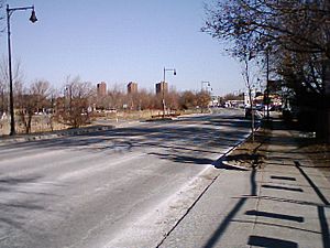
Fresh Pond Parkway in February 2010
|
|
| Maintained by | Department of Conservation and Recreation |
| Length | 1.0 mi (1.6 km) |
| Location | Cambridge, Middlesex County, Massachusetts |
| South end | |
| North end | |
| Construction | |
| Completion | 1899 |
|
Fresh Pond Parkway-Metropolitan Park System of Greater Boston
|
|
| Location | Cambridge, Massachusetts |
| Built | 1899 |
| Architect | Charles Eliot, Olmstead Brothers |
| MPS | Metropolitan Park System of Greater Boston MPS |
| NRHP reference No. | 04001429 |
| Added to NRHP | January 5, 2005 |
Fresh Pond Parkway is a special road and park area located in the western part of Cambridge, Massachusetts. It's not just a regular street; it's also a historic parkway that was built way back in 1899. Because of its history and design, it was added to the National Register of Historic Places in 2005, which means it's recognized as an important historical site.
What is Fresh Pond Parkway?
Fresh Pond Parkway is a four-lane road, meaning it has two lanes going in each direction. It stretches for about one mile (1.6 kilometers). On its southern end, it connects to Mount Auburn Street, a big road in western Cambridge. On its northern end, it reaches a large traffic circle (also called a rotary) where Concord Avenue and Alewife Brook Parkway meet.
A big part of the parkway runs along the eastern edge of the city's Fresh Pond reservoir. This reservoir is an important source of drinking water for Cambridge. The parkway also helps connect the reservoir area to the Charles River Reservation, which is a beautiful park system along the Charles River.
The parkway is part of several important routes: Massachusetts Route 2 and U.S. Route 3 run along its entire length. The northern part of the parkway, from Huron Avenue north, is also part of Massachusetts Route 16.
Exploring the Parkway's Path
The parkway starts near the Charles River, where it connects to other roads like Memorial Drive. At first, the north and southbound lanes are separated by a grassy area, which then narrows. This part of the road goes through Lowell Memorial Park and is lined with mature trees, making it feel like a green tunnel. There are also concrete sidewalks on both sides, separated by a narrow strip of grass, perfect for walking.
As you travel north, the parkway crosses Huron Avenue. From here, the road turns northeast and goes around Fresh Pond. This section is residential on one side and borders the Fresh Pond Reservation on the other. The Fresh Pond Reservation has public parking (for Cambridge residents) and facilities for the city's water supply. The very northern end of the parkway becomes more commercial before reaching the large traffic circle.
A Look Back: History of the Parkway
The idea for Fresh Pond Parkway came from a landscape designer named Charles Eliot in 1892. Eliot lived in Cambridge and had already helped design the Fresh Pond Reservation. He thought a parkway would be a great way to connect the Charles River area with the Middlesex Fells Reservation, another large park system.
In 1898, the Metropolitan Parks Commission, which is now part of the Massachusetts Department of Conservation and Recreation (DCR), started buying land to build the parkway. The first section, between Gerry's Landing and Huron Avenue, was finished in 1900. The northern part took a bit longer to complete, finally opening between 1928 and 1930, after some disagreements about its path and funding. The connection to the Eliot Bridge, which many people consider part of the parkway, wasn't finished until 1958.
In 2002, the northern part of the parkway was rebuilt. This project included adding new sidewalks and a special bike path on the west side, making it even better for people to enjoy the area around Fresh Pond.
 | Calvin Brent |
 | Walter T. Bailey |
 | Martha Cassell Thompson |
 | Alberta Jeannette Cassell |

