Charles River Reservation facts for kids
Quick facts for kids Charles River Reservation |
|
|---|---|

|
|
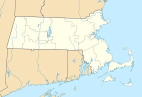
| Location | Middlesex, Suffolk, Massachusetts, United States |
| Area | 863 acres (349 ha) |
| Elevation | 13 ft (4.0 m) |
| Established | 1910 |
| Operator | Massachusetts Department of Conservation and Recreation |
| Website | Charles River Reservation |
|
Charles River Basin Historic District
|
|
| Lua error in Module:Location_map at line 420: attempt to index field 'wikibase' (a nil value). | |
| Location | Both banks of Charles River from Eliot Bridge to Charles River Dam, Cambridge, Massachusetts |
| Area | 820 acres (330 ha) |
| Built | 1893 |
| Architect | Multiple |
| Architectural style | Colonial Revival, Classical Revival, Moderne |
| NRHP reference No. | 78000436 |
| Added to NRHP | December 22, 1978 |
The Charles River Reservation is a 17-mile-long (27 km) park and outdoor space. It stretches along the banks of the Charles River in Boston, Cambridge, Watertown, and Newton, Massachusetts. The park is managed by the Department of Conservation and Recreation.
A special part of the reservation, between the Charles River Dam and the Eliot Bridge, is listed as a historic district. This means it's a special area recognized for its history. This section includes the famous Esplanade in the Back Bay area of Boston. The Charles River area above the Watertown Dam is known as the Upper Charles River Reservation.
Contents
Discover the Charles River Reservation
The Charles River Reservation has many interesting parts. These include the Charles River Dam, the Charles River Basin, the Boston and Cambridge Esplanades, and John F. Kennedy Park.
The Charles River Dam: Controlling the Water
The current Charles River Dam, built in 1978, is located behind the TD Garden. It helps control the water level in the river basin. An older dam, finished in 1910, was built to create a freshwater river and a park along its banks in Boston and Cambridge.
When the old dam was built, new land was created between the Longfellow Bridge and Charlesgate. This land became the Boston Embankment, now known as the Esplanade. The modern dam has six pumps that protect the area from floods. It also has a lock system that lets boats travel between the river and the harbor all year. A special fish passage helps fish like alewife and rainbow smelt swim upstream during their migration in late spring.
The Charles River Basin and Esplanades: A City Oasis
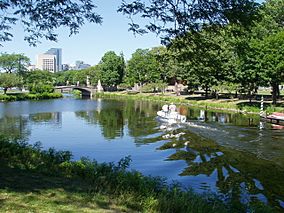
The Charles River Basin was created in 1910 by building a dam across the river. Before this, the river was affected by tides and had muddy areas. The dam turned it into a "water park" for city residents. It offered beautiful river views and chances for fun activities on both land and water.
Though entirely designed—and in that sense artificial—the Basin is also a wildlife habitat for hundreds of animal and plant species that play a role in the ecology of the region and enrich the experience of urban park users. Water quality in the once heavily polluted Basin has improved dramatically in recent years, creating better habitat for wildlife and attracting people back to the river.
The Basin changes its look along its 8.5-mile (13.7 km) length. It has three main parts:
- The Lower Basin: This section goes from the 1910 Charles River Dam to the Boston University Bridge. It is 2.5 miles (4.0 km) long and up to 2,000 feet (610 m) wide. The views here, including the Longfellow Bridge and the Beacon Hill slope with the gold dome of the State House, are iconic for Boston and Cambridge.
- The Middle Basin: This area is a mix of city and more natural, rural settings.
- The Upper Basin: This section stretches from Herter Park to the Watertown Dam.
Some areas within the reservation, like Magazine Beach and Herter Park, are very popular. They provide important open spaces for the nearby city neighborhoods.
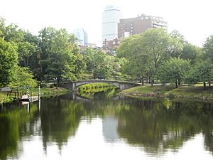
The Middle Basin acts as a transition zone. Parkways along the Charles River Basin separate the esplanades in Boston and Cambridge from the nearby neighborhoods. The largest open space here is between the Harvard University athletic fields and the Mount Auburn and Cambridge cemeteries. These areas are a vital resting spot for migrating birds.
In 1889, Frederick Law Olmsted designed Charlesbank. This was the first public space along the river. It included a walking path along the water. It also had the first public outdoor gyms in the United States. One was for women and girls near the Longfellow Bridge, and another for men and boys near Leverett Street.
John F. Kennedy Park: A Presidential Tribute
The 5-acre (2.0 ha) John F. Kennedy Park is located near Harvard Square. It is designed with plants that bloom around President Kennedy's May birthday. The park also features a memorial fountain.
Carol R. Johnson Associates of Boston designed the park. They used materials found in New England, like native trees. The granite fountain and entrance pillars have quotes from the President's speeches.
Riverbend Park: A Car-Free Zone
Riverbend Park is on the north side of the Charles River. It runs from the Eliot Bridge to Western Avenue in Cambridge. In 1974, Isabella Halsted, a local resident, suggested closing Memorial Drive to cars on Sundays. She wanted to create a peaceful space for people.
The next year, a part of the drive was closed for the first time. For nine years, a private group called the Trust for Riverbend Park raised money to keep the road closed. In 1985, the state government officially allowed and funded the permanent closing of the road from April to November. This created a wonderful car-free area for recreation.
Fun Activities at the Reservation
The Charles River Reservation offers many ways to have fun outdoors. You can go cycling on the Charles River Bike Paths. You can also enjoy boating, both with and without motors. There are playgrounds, places for picnics, swimming pools, and tennis courts. In winter, you can even go ice skating. The Hatch Memorial Shell hosts concerts and events.
If you want to try sailing, you can rent sailboats from the non-profit Community Boating, Inc. There's also a special quarter-mile (400 meter) Braille trail in Watertown. This trail is designed for people who are visually impaired.
 | Aurelia Browder |
 | Nannie Helen Burroughs |
 | Michelle Alexander |


