Fulton, Minneapolis facts for kids
Quick facts for kids
Fulton
|
|
|---|---|
|
Neighborhood
|
|

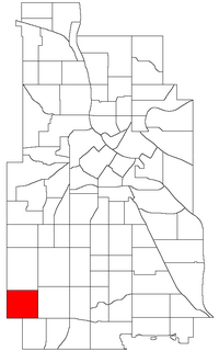
Location of Fulton within the U.S. city of Minneapolis
|
|
| Country | United States |
| State | Minnesota |
| County | Hennepin |
| City | Minneapolis |
| Community | Southwest |
| Area | |
| • Total | 0.877 sq mi (2.27 km2) |
| Population
(2010)
|
|
| • Total | 5,860 |
| • Density | 6,682/sq mi (2,580/km2) |
| Time zone | UTC-6 (CST) |
| • Summer (DST) | UTC-5 (CDT) |
| ZIP code |
55410
|
| Area code(s) | 612 |
| Historical population | |||
|---|---|---|---|
| Census | Pop. | %± | |
| 1980 | 6,647 | — | |
| 1990 | 5,988 | −9.9% | |
| 2000 | 5,566 | −7.0% | |
| 2010 | 5,860 | 5.3% | |
Fulton is a friendly neighborhood located in the big city of Minneapolis, Minnesota. It's part of the Southwest community. This area is known for its welcoming feel and convenient location. It's a great place where people live, learn, and play.
Contents
Exploring the Fulton Neighborhood
Fulton is a well-known neighborhood in Minneapolis. It has clear borders that help people know where it starts and ends. Understanding these boundaries helps you find your way around.
Where is Fulton Located?
The Fulton neighborhood is easy to find on a map. To the north, it reaches West 47th Street. Penn Avenue South forms its eastern edge. If you go south, you'll find West 54th Street. Finally, France Avenue South marks its western side.
Neighboring Communities
Fulton is surrounded by other cool neighborhoods. To the north, you'll find Linden Hills. Lynnhurst is located to the east. If you head south, you'll reach Armatage. The nearby town of Edina is just to the south and west.
Main Streets and Shopping
One of the most important streets in Fulton is West 50th Street. This street runs right through the middle of the neighborhood from east to west. It helps people travel and connect to different parts of the area.
The 50th & France Area
At the corner of West 50th Street and France Avenue, there's a special place called 50th & France. This is a popular shopping and dining area. It's known for its nice stores and restaurants. This lively spot sits right on the border between Minneapolis and Edina. It's a great place for families to visit and explore.
How Many People Live in Fulton?
The number of people living in Fulton has changed over the years. We can look at census data to see how the population has grown or shrunk. This information helps us understand the neighborhood better.
Population Changes Over Time
In 1980, about 6,647 people lived in Fulton. By 1990, this number went down slightly to 5,988 residents. In 2000, the population was 5,566. The most recent count from 2010 shows that 5,860 people call Fulton home. This shows that the population has been fairly stable in recent decades.
 | Percy Lavon Julian |
 | Katherine Johnson |
 | George Washington Carver |
 | Annie Easley |

