Galena Bay facts for kids
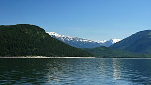
Galena Bay is a small, quiet place in southeastern British Columbia, Canada. It's located on a bay at the top of Upper Arrow Lake. This area is known for its beautiful scenery and interesting history. Today, Galena Bay is an important stop for the ferry that crosses the lake, connecting different parts of the region.
Quick facts for kids
Galena Bay
|
|
|---|---|
| Country | |
| Province | BC/BCE |
| Area code(s) | 250, 778 |
Contents
Galena Bay: A Historic Spot in British Columbia
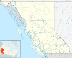
Galena Bay is an unincorporated locality. This means it's a community that doesn't have its own local government. It's located on a bay at the northern end of Upper Arrow Lake in the West Kootenay region of southeastern British Columbia.
Early History and First Peoples
For many years, the Sinix't Nation, also known as the Lake People, used Galena Bay. They visited the bay every year for hunting and fishing. The bay was especially good for catching kokanee salmon, which they called "redfish," in the autumn.
The Sinix't name for the bay means "the place to make canoes." This is because the large cottonwood trees there were perfect for making dugout canoes. In the late 1800s, there were some conflicts between the Sinix't people and new settlers. One event involved a Sinix't man named Cultus Jim, who was protecting his family's traditional camping rights. A creek in the area is now named after a settler from that time, Samuel Hill.
From Thumb Bay to Galena Bay
The bay was first called Thumb Bay on early maps because it looked like a giant thumb. But by 1890, its name was changed to Galena Bay. This new name came from the significant amount of galena mining that happened in the area. Galena is a type of lead ore.
In 1897, a townsite called Rosenheim was planned. A hotel was even built there. The idea was to create a railway linking Galena Bay with other mining towns like Camborne and Trout Lake. However, this railway project never happened, and the townsite plans faded away within a year. Still, the name Galena Bay remained for the community.
Logging and Early Plans
Even though the big railway wasn't built, a shorter rail line was constructed. This line helped bring huge old-growth trees like cedar, fir, hemlock, spruce, and white pine down the mountain. These logs were then taken to sawmills in Galena Bay and on the nearby peninsula. There was even a mill on Windy Point that made cedar shakes (a type of roofing material).
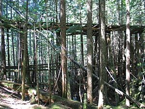
You can still see parts of the old railway's path in Galena Bay and on the hillside above the community. As recently as 2005, a wooden trestle bridge from this old railway still stood across a ravine above the modern highway.
Land Sales and the Minto Sternwheeler
A large area of land, about 162 hectares (400 acres), was surveyed into lots and sold. People also received land grants from the government, especially along Hill Creek and on the east side of the bay. For example, in 1898, William C. Marsdin bought a waterfront lot for $170.
This lot was later sold to John Nelson. He became well-known for owning a paddle-wheel boat called the Minto. The Minto was in bad shape and sat on his property for a long time. When the Keenlyside Dam was built in 1967, the lake level was going to rise. John's son, Walter Nelson, had to tow the old, broken-down ship out into the lake and burn it to clear the area.
Around 1899, the fancy Hotel Rosenheim was built in Galena Bay. A school was also built for the community's children.
The Changing Landscape: Dams and Ferries
In 1957, Galena Bay became the eastern end of the Arrowhead–Galena Bay ferry route. A road, which was called a highway, was built from Nakusp. It went around Galena Bay, crossed Hill Creek with a timber bridge, and continued across the peninsula to the ferry landing. This old ferry landing was a popular swimming spot because of its clear, rocky shore.
A big change happened between 1967 and 1968. BC Hydro, a power company, raised the lake level by about 50 meters. This created a larger reservoir as part of the Columbia River Treaty with the United States. Because of this, the highway had to be moved to a higher location, on a straighter path towards Trout Lake.
The new highway was finished in 1973. It included a turnoff to a new ferry landing further down the shoreline from Galena Bay. This new ferry connected with a new Highway 23 across the lake at Shelter Bay. There was also another turnoff into Galena Bay, though it was never paved.
Since 1968, the western end of the ferry route has been Shelter Bay. This ferry link is now part of British Columbia Highway 23, connecting Nakusp to Revelstoke. Galena Bay is also where British Columbia Highway 31 begins. This highway goes northeast, then southeast through Trout Lake and Lardeau, and then south along the west side of the northern part of Kootenay Lake to Balfour, which is near Nelson.
 | Stephanie Wilson |
 | Charles Bolden |
 | Ronald McNair |
 | Frederick D. Gregory |


