Shelter Bay, British Columbia facts for kids
Quick facts for kids
Shelter Bay
|
|
|---|---|
| Country | |
| Province | BC/BCE |
| Area code(s) | 250 / 778 / 236 |
| Highways | |
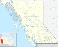
Shelter Bay is a small place in British Columbia, Canada. It's not a city or town with its own government. Instead, it's known as an "unincorporated locality." This means it's a small community that is part of a larger area. Shelter Bay is located right on the shore of Upper Arrow Lake.
What is Shelter Bay?
Shelter Bay is mainly a ferry landing. This means it's a special spot where a ferry boat docks. It's a very important stop for people traveling in this part of British Columbia.
The Upper Arrow Lake Ferry
Shelter Bay is one end of the Upper Arrow Lake Ferry route. This ferry crosses the lake to a place called Galena Bay. The ferry ride helps people and cars get across the water easily.
Connecting Highways
The ferry at Shelter Bay is a key link for travelers. It connects British Columbia Highway 23 from Revelstoke. After crossing the lake to Galena Bay, Highway 23 continues on to Nakusp. This part of the highway runs along the east side of Upper Arrow Lake.
The ferry also helps connect to British Columbia Highway 31. This highway starts near Galena Bay. It travels through Galena Pass to Lardeau on Kootenay Lake. From there, it goes down the west side of Kootenay Lake to Balfour. So, Shelter Bay is a small but mighty hub for travel!
 | John T. Biggers |
 | Thomas Blackshear |
 | Mark Bradford |
 | Beverly Buchanan |


