Arrow Lakes facts for kids
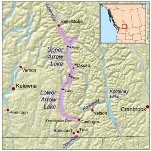
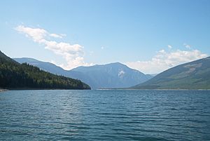
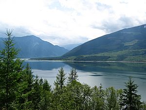
The Arrow Lakes are a beautiful part of British Columbia, Canada. They are actually two lakes, called Upper Arrow Lake and Lower Arrow Lake. These lakes are wide parts of the famous Columbia River. You can find them nestled between two large mountain ranges: the Selkirk Mountains on the east and the Monashee Mountains on the west.
The land around the lakes doesn't have many beaches. Instead, you'll see rocky areas and steep cliffs. The mountainsides are covered in thick forests and rise very high, up to about 2,600 meters (8,500 feet).
Long ago, the Upper and Lower Arrow Lakes were separate, about 22 kilometers (14 miles) apart. But in the 1960s, the Keenleyside Dam was built. This dam created a large reservoir, which made the two lakes join together into one long lake, about 230 kilometers (143 miles) long! When the water level is low, you can still see the two lakes connected by a fast-moving section called the Narrows.
When the dam was built, the water level rose about 12 meters (39 feet) higher than before. This meant that a lot of farmland in the valley was covered by water. Thousands of people had to move their homes. The lake now stretches from just north of Castlegar in the south all the way to Revelstoke in the north. Another dam, the Whatshan Dam, also sends water from Whatshan Lake into the Arrow Lakes.
Contents
Getting Around the Lakes
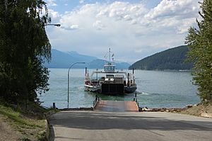
There are a few free ferries that help people cross the Arrow Lakes:
- The Upper Arrow Lake Ferry connects Shelter Bay and Galena Bay at the northern end of Upper Arrow Lake.
- The Needles Cable Ferry is further south on BC Highway 6. It connects Nakusp and Vernon.
- The Arrow Park Ferry is another cable ferry. It connects East Arrow Park and West Arrow Park, about 28 kilometers (17 miles) south of Nakusp.
First Peoples of the Arrow Lakes
The Arrow Lakes area is a very old and important place for several Indigenous groups. These include the Sinixt, Okanagan, and Ktunaxa peoples. When European settlers first arrived, only the Sinixt people were living along the shores of the Arrow Lakes.
Why the Name "Arrow Lakes"?
The name "Arrow Lakes" is widely used, but it's actually not the official name for the combined body of water. Officially, they are still called "Upper Arrow Lake" and "Lower Arrow Lake." However, the name "Arrow Lakes" comes from a special place called "Arrow Rock."
Arrow Rock was a large rock that hung over the water on the east side of Lower Arrow Lake. It had a hole filled with arrows! People believed these arrows were shot there by the Sinixt people (also known as the Lakes people). They would shoot arrows into the rock for good luck, either before or after going to war.
One story tells of a time when a large group of warriors was traveling up the river. A big storm suddenly hit, and their canoes were destroyed. The Slocan people, who were preparing for battle against them, saw this as a gift from a powerful spirit. To show their respect, they shot all their arrows at the high rock and carved symbols on it. Because so many arrows fell into the lake that day, the area became known as "Arrow Lake."
Gallery
See also
 In Spanish: Lagos Arrow para niños
 | Toni Morrison |
 | Barack Obama |
 | Martin Luther King Jr. |
 | Ralph Bunche |


