Gawler South facts for kids
Quick facts for kids Gawler SouthAdelaide, South Australia |
|||||||||||||||
|---|---|---|---|---|---|---|---|---|---|---|---|---|---|---|---|
| Postcode(s) | 5118 | ||||||||||||||
| LGA(s) | Town of Gawler | ||||||||||||||
| State electorate(s) | Light | ||||||||||||||
| Federal Division(s) | Spence | ||||||||||||||
|
|||||||||||||||
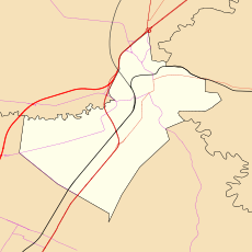
Gawler South is a suburb in South Australia. It's part of the larger town of Gawler. You can find it about 43 kilometers north of Adelaide, which is the capital city.
Gawler South is surrounded by other areas. To its north is Gawler, and to the west is Gawler West. Other neighbors include Evanston, Evanston Park, and Bibaringa. The South Para River also forms one of its borders.
Contents
A Look at Gawler South's Past
Gawler South started as a planned part of the Gawler township. It was divided into many blocks of land. The streets here were given simple names, like First Street up to Twenty Fourth Street. Some streets were named after important local people or even royal family members.
In the past, Gawler South became home to a railway station and a tram line. There was also a racecourse and an Anglican Church built here. These places were important during the time when Australia was still a group of colonies.
The Railway's Story
A railway line was built from Adelaide to Gawler in 1879. The main Gawler railway station was built right here in Gawler South. Later, in 1911, the railway was extended. It went through the beautiful Barossa Valley all the way to Angaston.
Today, the Gawler South Station is still used. It's a place where trains are kept for the line that goes to Adelaide.
How Gawler South is Laid Out
The houses and streets in Gawler South are arranged in different ways. This is because the suburb grew in stages over time. For example, the area near the railway station has streets that mostly run north to south.
The main shopping area along Adelaide Road has a different street pattern. It's set at an angle to the railway area. After World War II, a new housing area was built. This part is on the flat land between the South Para River and the Gawler River.
Gawler South Today
In the 1990s, new houses were built on the hills. These new homes are close to the South Para River.
The shopping area in Gawler South is still very busy. It's like an extension of Gawler's main shopping district. It stretches for almost a kilometer along Adelaide Road, crossing the bridge over the South Para River.
Understanding Gawler South's Geography
Many of the older streets in Gawler South have number names. You'll find streets like First Street all the way to Twentyfifth Street. There isn't a clear pattern to how these streets are laid out or why they are numbered that way. Some streets on the eastern side follow the shape of the land. This is because the land there is too steep to build on in a straight line.
How Gawler South is Governed
Gawler South is managed by the local council, which is called the Town of Gawler. For state government elections, Gawler South is part of the Light area. For federal government elections, it belongs to the Spence area.


