Geikie River (Saskatchewan) facts for kids
Quick facts for kids Geikie River |
|
|---|---|
|
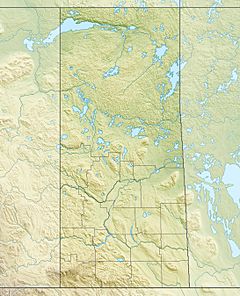
Location of the mouth of the Geikie River in Saskatchewan
|
|
| Country | Canada |
| Province | Saskatchewan |
| Physical characteristics | |
| Main source | Costigan Lake 543 m (1,781 ft) 56°58′14″N 105°52′33″W / 56.97056°N 105.87583°W |
| River mouth | Wollaston Lake 398 m (1,306 ft) 57°45′00″N 103°52′02″W / 57.75000°N 103.86722°W |
| Basin features | |
| River system | Mackenzie River drainage basin and Churchill River drainage basin |
| Basin size | 7,730 km2 (2,980 sq mi) |
The Geikie River is an interesting river in northern Saskatchewan, Canada. It starts at Costigan Lake and flows northeast until it reaches Wollaston Lake. This area is close to where uranium is mined, in a region called the Athabasca Basin.
What makes the Geikie River special is how its water flows. It feeds into Wollaston Lake, which is the biggest natural "bifurcation lake" in the world. A bifurcation lake is a lake that has two different outlets, meaning its water can flow out in two separate directions.
The Geikie River is unique because its waters can end up in two different oceans! Some of its water flows towards the Arctic Ocean, while other parts flow towards Hudson Bay. If we consider Hudson Bay as part of the Atlantic Ocean, then the Geikie River is the largest river in the world that naturally drains into two oceans.
How the Water Flows
The Geikie River's water enters Wollaston Lake. From there, the water can take one of two paths:
Path to the Arctic Ocean
- One path leads to the Fond du Lac River.
- This river flows northwest out of Wollaston Lake.
- It then drains into Lake Athabasca.
- Finally, the water reaches the Arctic Ocean through the large Mackenzie River system.
Path to Hudson Bay
- The other path leads to the Cochrane River.
- This river flows out of the northeastern side of Wollaston Lake.
- It then goes into Reindeer Lake.
- From Reindeer Lake, the water drains into Hudson Bay through the Churchill River system.
Getting to the River
You can access the Geikie River where it is crossed by Saskatchewan Highway 905. This crossing is located at the 184-kilometre mark of the highway.
 | Selma Burke |
 | Pauline Powell Burns |
 | Frederick J. Brown |
 | Robert Blackburn |


