Georges River Canal facts for kids
Quick facts for kids |
|
|
Georges River Canal
|
|

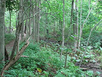
Remnants of the canal bed in Payson Park, Warren
|
|
| Location | Upper Falls, Georges River in Warren, Maine to Union town line, extending to Quantabacook Pond in Searsmont |
|---|---|
| Area | 2,200 acres (890 ha) |
| Built | 1846 |
| NRHP reference No. | 70000048 |
| Added to NRHP | March 5, 1970 |
The Georges River Canal was a waterway in central Maine. It was also called the General Knox Canal. This canal was used for only a short time.
It was first used by American Revolutionary War General Henry Knox from 1794 to 1806. Later, it was briefly reopened from 1847 to 1850. But it never made enough money to be successful.
The canal helped move goods from Searsmont down to Warren. This was where boats could easily travel on the Saint George River. Today, you can still see parts of the old canal. Its path was added to the National Register of Historic Places in 1970.
Building the First Canal (1793)
In 1793, a local business owner named Charles Barrett got permission. He wanted to build a canal on the Saint George River. This canal would help move lumber more easily.
He built wooden locks at Upper Falls in Warren. Locks are special gates that help boats move between different water levels. He also built locks a few miles upriver at Hart's Falls. This allowed boats to travel as far as Seven Tree Pond in Union.
General Henry Knox bought Barrett's canal in 1794. He ran it until he passed away in 1806. Knox made the dam at Upper Falls taller. This meant the locks at Hart's Falls were no longer needed. He also moved the mills that used water power.
One year, a big spring flood damaged the lock. It had to be rebuilt. After Knox's death, the canal was no longer used. However, people still wanted better ways to move goods along the river.
The Canal's Second Try (1847)
Other successful canals, like the Erie Canal in New York and the Cumberland and Oxford Canal in southern Maine, made people interested again. This happened in the 1820s and 1830s.
But it wasn't until 1846 that the state approved a new plan. The new canal was supposed to go all the way to Saint George Lake in Liberty. However, it opened in 1847 and only reached Quantabacook Lake in Searsmont.
Keeping the canal in good shape was very expensive. Its locks were made of wood. Also, the river was often rough and fast-moving. This meant the canal needed frequent repairs. Travel on the canal was often stopped. The canal stopped working in 1850.
In 1865, the dam and lock at Upper Falls were rebuilt. This time, they were made of strong stone. They provided water power for local mills. It was rebuilt again in 1902 to create electricity. But a big flood in 1936 washed it away.
What Remains Today
Today, you can only find small signs of the old canal. These include old paths where animals would pull boats. You can also see parts of the foundations of the locks and dams.
In Searsmont, the Georges River Land Trust takes care of a hiking trail. This trail is about 3-mile (4.8 km) long. It follows part of the old towpath. Along the way, you can see several remains of the old locks. In Warren, you can see part of the canal path at Payson Park.
 | Isaac Myers |
 | D. Hamilton Jackson |
 | A. Philip Randolph |


