Giboney, Missouri facts for kids
Quick facts for kids
Giboney, Missouri
|
|
|---|---|
|
Abandoned village
|
|

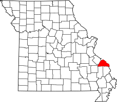
Location of Perry County, Missouri
|
|
| Country | United States |
| State | Missouri |
| County | Perry |
| Township | Saline |
| Elevation | 512 ft (156 m) |
| Time zone | UTC-6 (Central (CST)) |
| • Summer (DST) | UTC-5 (CDT) |
| ZIP code |
63775
|
| Area code(s) | 573 |
| FIPS code | 29-26945 |
| GNIS feature ID | 740869 |
Giboney was a small, unnamed community in Perry County, Missouri. It was located in Saline Township. Today, it is an abandoned village.
Contents
What Was Giboney?
Giboney was an "unincorporated community." This means it was a small group of homes or buildings. It did not have its own local government. It was located in the northwest part of Perry County, Missouri.
Where Was Giboney Located?
Giboney was found just west of a place called Brewer. It was situated along the South Fork Saline Creek. State Route NN also ran nearby. The community was about 26.5 miles from the Mississippi River.
The Railroad Connection
Giboney was an important stop on the Saline Valley Line. This was a railroad line that helped connect different areas. The station was on Old Lead Road. It was located between the Brewer and Minnith stations. These were all part of the Cape Girardeau Northern Railway. This railway ran from Ancell to Farmington.
Louis Houck and the Railroad
A man named Louis Houck built the Cape Girardeau & Chester Railroad in 1905. This railroad later became the Cape Girardeau Northern Railroad. Some people believe Giboney might have been named after Louis Houck's wife, Mary H. Giboney.
However, the railroad faced many money problems. This led to its bankruptcy. By around 1925, the train service was very limited. It only ran to stations in Cape Girardeau. This meant Giboney was no longer a busy railroad stop.
 | Georgia Louise Harris Brown |
 | Julian Abele |
 | Norma Merrick Sklarek |
 | William Sidney Pittman |

