Gila Crossing, Arizona facts for kids
Quick facts for kids
Gila Crossing, Arizona
O'odham: Kuiwa
|
|
|---|---|
 |
|

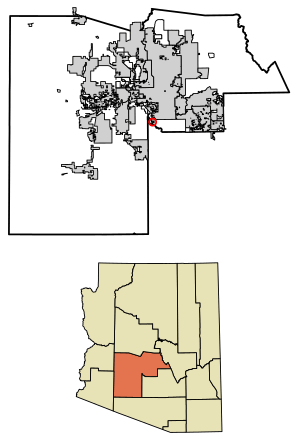
Location in Maricopa County, Arizona
|
|
| Country | United States |
| State | Arizona |
| County | Maricopa |
| Area | |
| • Total | 0.87 sq mi (2.25 km2) |
| • Land | 0.87 sq mi (2.25 km2) |
| • Water | 0.00 sq mi (0.00 km2) |
| Population
(2020)
|
|
| • Total | 636 |
| • Density | 731.03/sq mi (282.16/km2) |
| Time zone | UTC-7 (MST (no DST)) |
| ZIP code |
85339
|
| Area code(s) | 520 |
| FIPS code | 04-27260 |
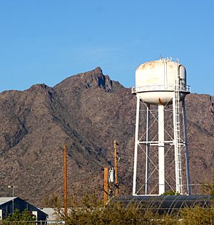
Gila Crossing, known as Kuiwa in the O'odham language, is a small community in Maricopa County, Arizona. It is a special type of place called a census-designated place (CDP). This means it's a community that the U.S. Census Bureau defines for gathering population data. Gila Crossing is part of the Gila River Indian Community. In 2020, about 636 people lived here.
Where is Gila Crossing?
Gila Crossing is located in the southern part of the Phoenix metropolitan area in Arizona. It sits in the valley of the Gila River. To its north are the communities of Komatke and St. Johns. About 3 miles (4.8 km) to the south, across the Gila River, is Santa Cruz, which is in Pinal County. If you travel northeast, you'll reach Downtown Phoenix, which is about 16 miles (26 km) away.
People of Gila Crossing
| Historical population | |||
|---|---|---|---|
| Census | Pop. | %± | |
| 2020 | 636 | — | |
| U.S. Decennial Census | |||
In 2010, there were 621 people living in Gila Crossing. Most of the people living here are Native American, making up about 84% of the population. Other groups include White (3%), Black or African American (1%), and people from other backgrounds. About 15% of the population identified as Hispanic or Latino.
Getting Around Gila Crossing
The community has a local transportation service called Gila River Transit. This service helps connect Gila Crossing with nearby places like Komatke and Maricopa Colony.
See also
 In Spanish: Gila Crossing para niños
 | Aaron Henry |
 | T. R. M. Howard |
 | Jesse Jackson |


