Gilmore, Arkansas facts for kids
Quick facts for kids
Gilmore, Arkansas
|
|
|---|---|
 |
|

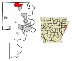
Location of Gilmore in Crittenden County, Arkansas.
|
|
| Country | United States |
| State | Arkansas |
| County | Crittenden |
| Area | |
| • Total | 13.54 sq mi (35.07 km2) |
| • Land | 13.52 sq mi (35.01 km2) |
| • Water | 0.03 sq mi (0.07 km2) |
| Elevation | 220 ft (70 m) |
| Population
(2020)
|
|
| • Total | 176 |
| • Density | 13.02/sq mi (5.03/km2) |
| Time zone | UTC-6 (Central (CST)) |
| • Summer (DST) | UTC-5 (CDT) |
| ZIP code |
72339
|
| Area code(s) | 870 |
| FIPS code | 05-27040 |
| GNIS feature ID | 2403698 |
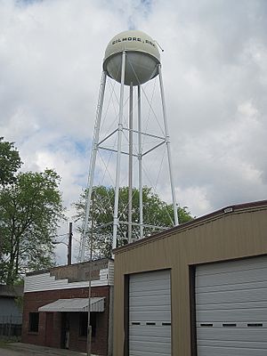
Gilmore is a small city in Crittenden County, Arkansas. It's located in the United States. According to the 2020 census, about 176 people live there.
Contents
Where is Gilmore Located?
Gilmore is in the northern part of Crittenden County. The city of Turrell is right next to it, to the south.
Travel and Roads in Gilmore
Major roads like Interstate 555 and U.S. Routes 61 and 63 go through the western part of Gilmore. These roads connect Gilmore to other cities. For example, you can travel about 44 miles (71 km) northwest to Jonesboro. Or, you can go south about 20 miles (32 km) on Interstate 55 to reach West Memphis.
Land and Water Around Gilmore
The United States Census Bureau says Gilmore covers about 0.6 square kilometers (0.23 sq mi) of land. There isn't any significant water area within the city limits.
Nature and Environment in Gilmore
Gilmore is in a special natural area called the Northern Backswamps. This area is part of the larger Mississippi Alluvial Plain. It has many low-lying areas and floodplains. Historically, these areas were covered by forests. These forests included trees like bald cypress, water tupelo, and different types of oak trees. These trees are used to living in areas that are flooded all year or during certain seasons.
Southeast of Gilmore, you can find the Wapanocca National Wildlife Refuge. This refuge protects some of the original bald cypress forests. These forests were common in this area before much of the land was used for farming.
How Many People Live in Gilmore?
The number of people living in Gilmore has changed over the years. Here's a quick look at the population from different census counts:
| Historical population | |||
|---|---|---|---|
| Census | Pop. | %± | |
| 1960 | 438 | — | |
| 1970 | 461 | 5.3% | |
| 1980 | 503 | 9.1% | |
| 1990 | 331 | −34.2% | |
| 2000 | 292 | −11.8% | |
| 2010 | 188 | −35.6% | |
| 2020 | 176 | −6.4% | |
| U.S. Decennial Census 2010 2020 |
|||
Who Lives in Gilmore?
The 2020 census showed that Gilmore is home to people from different backgrounds. Most residents are Black or African American, making up about 58% of the population. White residents make up nearly 29%. About 10% of the population is Hispanic or Latino. A small number of people identify as mixed race.
Schools in Gilmore
Students in Gilmore attend schools in the Marion School District. The main high school for students from Gilmore is Marion High School.
Before 2010, Gilmore was part of the Turrell School District. However, on July 1, 2010, the Turrell district joined with the Marion School District. This change led to the closing of the former Turrell High School.
See also
 In Spanish: Gilmore (Arkansas) para niños

