Gilson Mountains facts for kids
Quick facts for kids Gilson Mountains |
|
|---|---|

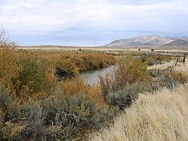
Southwest flank of Gilson Mountains,
October 2005 |
|
| Highest point | |
| Peak | Champlin Peak |
| Elevation | 7,504 ft (2,287 m) |
| Dimensions | |
| Length | 11 mi (18 km) SSW x NNE |
| Width | 8 mi (13 km) |
| Geography | |
| Country | United States |
| Communities | Jericho Junction, Champlin, Soma, Uisco, Leamington and Mack |
The Gilson Mountains are a small mountain range in Juab County, Utah, United States. They are about 11-mile (18 km) long and have an almost circular shape. These mountains are right next to the northern end of the Canyon Mountains.
Contents
About the Gilson Mountains

The Gilson Mountains look like an oval or egg shape. They stretch about 11-mile (18 km) from the south-southwest to the north-northeast. The middle of the range has a main central part, and from there, two ridges extend towards the southwest.
Between these two ridges is a place called Broad Canyon. To the northwest, another large canyon, Long Canyon, is next to the central ridge. There is also a ridge that goes northeast from the main central peak. A dirt road, Gilson Road, lets you get into the canyon on the north side. It goes to an area just northeast of the main peak.
Champlin Peak: The Highest Point
The tallest spot in the Gilson Mountains is Champlin Peak. It stands at 7,504 feet (2,287 m) high.
Location and Nearby Areas
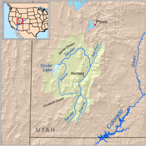
The Sevier River separates the Gilson Mountains from the Canyon Mountains. The river flows through a narrow path and canyons. It flows northeast, then southwest, and then west past the Gilson Mountains' southwest side. This is where the Sevier River enters the Sevier Desert, which is part of the Great Basin. The river travels through many mountains, valleys, and plateaus before reaching the desert.
To the northwest of the Gilson Mountains is the Little Sahara Recreation Area. This area is full of desert and sand dunes. The Little Sahara site is a bit bigger than the Gilson Mountains themselves.
How to Get to the Gilson Mountains
You can reach the Gilson Mountains using a few main roads.
Major Roads Near the Mountains
U.S. Route 6 (US-6) runs along the northeast edge of the Sevier Desert. This is on the west and northwest sides of the Gilson Mountains. Near the northern part of the range, at Jericho Junction, a paved road goes west and then southwest. This road leads into the desert flatlands, hills, and sand dunes of the Little Sahara Recreation Area, including the Sand Mountain recreation site. Many dirt roads from US-6 also let you get to the west and north sides of the mountains.
Utah State Route 132 (SR-132) comes from Lynndyl and Leamington to the west. It travels along the south and southeast sides of the Gilson Mountains, following the path of the Sevier River and its canyons. Near the middle of the southeast side, at Soma, the Sevier River turns southeast. It then follows the northeast side of the Canyon Mountains. From the Gilson Mountains' southeast side, SR-132 continues northeast through a hilly and mountainous area. This area is south of the East Tintic Mountains, and the road goes on to Nephi, which is about 25-mile (40 km) away.
 | Misty Copeland |
 | Raven Wilkinson |
 | Debra Austin |
 | Aesha Ash |


