Sevier Desert facts for kids
Quick facts for kids Sevier Desert |
|
|---|---|

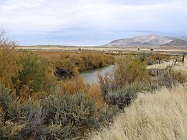
Gilson Mountains, Sevier River entering the east Sevier Desert at Leamington
|
|
| Length | 105 mi (169 km) |
| Width | 60 mi (97 km) |
| Geography | |
| Country | United States |
| State | Utah |
| Counties | Juab and Millard |
| Borders on | Ferguson Desert-W Great Salt Lake Desert-NW & NNW Gilson & Canyon Mountains, and Pahvant Range-E Escalante Desert-SW |
| River | Sevier River |
| Lake | Sevier Lake |
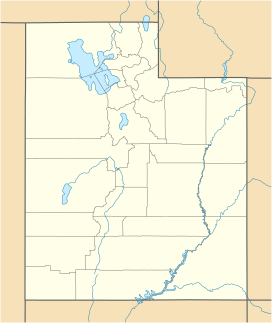
The Sevier Desert is a big, dry area in central-west Utah, United States. It's part of the larger Great Basin region. Other deserts surround it to the north, west, and south. To the east, you'll find mountain ranges and valleys. These include the East Tintic Mountains, Gilson Mountains, Canyon Mountains, and the huge Pahvant Range.
The Sevier River winds its way through the desert. It eventually flows into Sevier Lake in the desert's far southwest. The river enters the eastern desert flowing west. Then it turns southwest and west again before reaching the northern part of Sevier Lake.
In the southeast part of the desert, you'll find the Black Rock Desert volcanic field. This area has cool features like Pahvant Butte, which formed when a huge ancient lake called Lake Bonneville was around. This volcanic area is west of a farming region with cities like McCornick and Fillmore.
The Little Sahara Recreation Area is located in the northeast part of the Sevier Desert. It's a popular spot for outdoor fun.
Contents
Exploring the Sevier Desert
The Sevier Desert stretches about 105 miles (169 km) from north to south. It is about 60 miles (97 km) wide. This desert covers a large part of the area where the Sevier River collects water. It also takes up much of the eastern half of Millard County. The desert gets its name from the Sevier River. The name "Sevier" comes from "Río Severo," which means "wild river" in Spanish. Early Spanish explorers gave it this name.
In the north and northwest, the desert has small mountain ranges, valleys, and flat areas. It also borders the southern part of the Great Salt Lake Desert. Near the Great Salt Lake Desert, you'll find the Dugway Range and Dugway Valley. These are next to the Thomas Range to the southeast. The Thomas Range and Drum Mountains are just west of the Little Sahara Recreation Site. There's a large flatland in between, drained by Cherry Creek Wash. This area has small lakes that sometimes dry up, like Hogback and Desert Mountain Reservoir. It also has springs and wells. You can also find Fumarole Butte here, which is about 5,278 feet (1,609 m) tall. It's about 10 miles (16 km) east of the Drum Mountains.
Geographical Features
The western edge of the Sevier Desert runs mostly north to south. This is because of the House Range mountains. The southern edge of the desert runs mostly east to west. Mountains in the south separate the Sevier Desert from the Escalante Desert. The Escalante Desert is a roughly triangle-shaped desert surrounded by mountains. It also includes the Escalante Valley and Cedar Valley.
The eastern part of the Sevier Desert has towns located at the base of the mountains. The Black Rock Desert volcanic field is west of these towns. Pavant Valley is west of the Pahvant Range. West of the Canyon Mountains, you'll find the Oak Creek Sinks. These are east of the Sevier River and west of Oak City.
The northeast edge of the desert is at the southwest base of the East Tintic Mountains. This area is known for its mining history. Tintic Valley is a small valley between the West Tintic Mountains. It drains southwest into the Sevier Desert. West of the West Tintic Mountains are two more mountain ranges: the southwest part of the Sheeprock Mountains and the smaller, round Simpson Mountains.
To the west and southwest, beyond the House Range, is the Ferguson Desert. The Confusion Range and Tule Valley are located between the House Range and the Ferguson Desert.
Cities and Landmarks
Here are some of the towns and natural landmarks found around the edges of the Sevier Desert.
|
West Desert Edge
|
East Desert Edge
|
|
North Desert Edge
|
South Desert Edge
|
Getting Around the Desert
Interstate 15 runs along the southeast edge of the desert, near the mountain foothills. Utah State Route 257 goes north, then northeast, through the central-eastern part of the desert. It starts from Black Rock, Utah and goes to Oasis. U.S. 6 continues northeast from Oasis to Jericho and McIntyre, which are at the desert's northeast edge. U.S. 6 is also the road you take to get to the Little Sahara Recreation Area in the northeast.
 | Isaac Myers |
 | D. Hamilton Jackson |
 | A. Philip Randolph |


