Pahvant Butte facts for kids
Quick facts for kids Pahvant Butte |
|
|---|---|
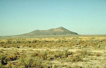
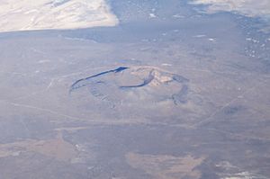
Pahvant Butte, 1991
|
|
| Geography | |
| Country | United States |
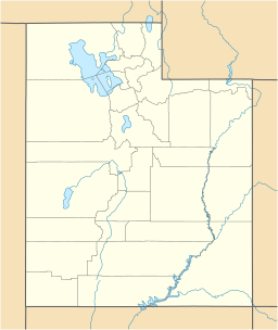
| State | Utah |
| Region | Black Rock Desert volcanic field |
| District | Millard County |
| Range coordinates | 39°07′54″N 112°33′08″W / 39.13167°N 112.55222°W |
| Topo map | USGS Pahvant Butte North, Utah and Pahvant Butte South, Utah |
Pahvant Butte (sometimes called Pavant Butte) is a large hill in west-central Utah, United States. It was formed by a dormant (sleeping) volcano.
Contents
Discovering Pahvant Butte
Pahvant Butte is found in the Sevier Desert, within the Pahvant Valley. It's about 15.7 miles (25.3 km) south of Delta. You can also find it five miles east of Clear Lake and its Wildlife Management Area.
This cool landform has two main peaks. The north peak reaches about 5,751 ft (1,753 m) high. The south peak is a bit lower, at 5,486 ft (1,672 m). Both peaks stand about 1000 feet above the flat valley floor around them. At its base, the butte is about 1.5 mi (2.4 km) wide.
How Pahvant Butte Formed
Pahvant Butte was created in an area where volcanoes were very active long ago. It formed on top of older pahoehoe and aa lava flows. These are different types of lava that cool into unique shapes.
This volcano was originally a subaqueous volcano. This means it erupted underwater! It burst out from the floor of Lake Bonneville about 15,500 years ago. Lake Bonneville was a huge ancient lake that once covered much of Utah.
An Unusual Structure
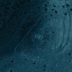
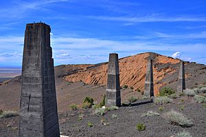
On the southeast side of the volcano's inner dip, there's a strange, unfinished structure. It includes a concrete building built into the hill. This building is surrounded by two rings made of concrete pillars, called obelisks.
It seems a man named A. H. Hood started building this in 1923. He supposedly wanted to use it to generate power from the wind.
Geology and Lake Bonneville
Pahvant Butte is part of the Black Rock Desert volcanic field. This field dates back to the Pleistocene and Holocene ages, which are periods in Earth's history. The butte formed over older lava flows from the Pahvant field.
As mentioned, the volcano was originally a subaqueous volcano. This means it formed underwater in Lake Bonneville during a huge eruption about 15,500 years ago. Scientists think the water was about 85 m (279 ft) deep when it erupted.
This powerful eruption likely shot steam, ash (volcanic dust), and other materials high out of the lake. It would have covered the nearby land with ash and created giant waves in the lake! The eruption also released tiny pieces of basaltic lava into the air. These bits fell back down to form a type of rock called tuff.
The Lace Curtain Cliff
Around the lower part of the volcano, you can see a "raised beach" or terrace. This was formed by waves from Lake Bonneville. On the north side of the volcano, there's a tall cliff called the "Lace Curtain." This cliff was shaped by strong storm waves.
The name "Lace Curtain" comes from the unique white, lace-like pattern on the cliff face. This pattern was created when minerals from groundwater partly "cemented" (stuck together) the tuff rock.
Pahvant Butte was later covered by lava flows from the Ice Springs eruption. This happened sometime between 1140 and 1440 AD.
What Pahvant Butte Looks Like
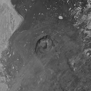
The Pahvant Butte volcano is an uneven tuff cone. A tuff cone is a type of volcano made from volcanic ash and rock fragments. It has a break on its southwestern side.
There's also a flat area that stretches to the southeast of the cone. This area is made of layers of tephra (rock fragments from an eruption) that slope steeply away from the cone. These layers partly hide a mound of sideromelane tephra that lies almost flat underneath.
 | William M. Jackson |
 | Juan E. Gilbert |
 | Neil deGrasse Tyson |


