Canyon Mountains facts for kids
Quick facts for kids Canyon Mountains |
|
|---|---|
| Highest point | |
| Peak | Fool Creek Peak |
| Elevation | 9,717 ft (2,962 m) |
| Dimensions | |
| Length | 25 mi (40 km) SSW x NNE |
| Width | 12 mi (19 km) |
| Geography | |
| Country | United States |
| Communities | Oak City, Leamington, Mills, Scipio and McCornick |
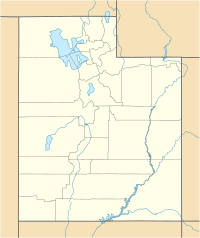
The Canyon Mountains are a mountain range in Utah, United States. They stretch about 25 miles (40 km) long. You can find them mostly in the northeast part of Millard County, Utah. A small section of the range also goes into Juab County, Utah.
These mountains are part of the northern Fishlake National Forest. To their west, you'll find the Sevier Desert and the Sevier River.
Where Are the Canyon Mountains?
The Canyon Mountains are a small part of a larger area called the Basin and Range Province. This area has many mountains and valleys. To the north, the Canyon Mountains connect with the smaller Gilson Mountains.
To the southeast, they join the Pahvant Range, which is also part of the Fishlake National Forest. A major road, Interstate 15, passes between these two ranges. It goes northeast towards towns like Scipio and Nephi, Utah.
Highest Point: Fool Creek Peak
The tallest spot in the Canyon Mountains is Fool Creek Peak. It stands at 9,717 feet (2,962 meters) high. This peak is located right on the border between Millard and Juab counties.
The Sevier River's Journey
The Sevier River flows near the Canyon Mountains. It enters the northeast Sevier Desert just north of the range. The river also borders the southern part of the Gilson Mountains.
The Sevier River is important because it's the last river to leave the mountains and valleys in this area. It flows north along the eastern side of the Valley Mountains. Then, it turns northwest past the Gilson and Canyon Mountains into the Sevier Desert. Finally, it flows southwest towards towns like Leamington and Delta.
 | Charles R. Drew |
 | Benjamin Banneker |
 | Jane C. Wright |
 | Roger Arliner Young |


