Gorrie Lake (Ontario) facts for kids
Quick facts for kids Gorrie Lake |
|
|---|---|
| Location | Timiskaming District, Ontario |
| Coordinates | 47°07′21″N 79°32′39″W / 47.12250°N 79.54417°W |
| Primary inflows | Two unnamed creeks |
| Primary outflows | Unnamed creek to Fourbass Lake |
| Basin countries | Canada |
| Max. length | 1.4 km (0.87 mi) |
| Max. width | 0.7 km (0.43 mi) |
| Surface elevation | 300 m (980 ft) |
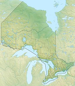
Gorrie Lake is a beautiful lake located in the Timiskaming District of Ontario, Canada. It is found about 23 kilometres (14 mi) east of the town of Temagami. This lake is a great example of the many natural wonders in the region.
Facts About Gorrie Lake
Gorrie Lake is not huge, but it's a good size for exploring! It stretches about 1.4 kilometres (0.9 mi) long and 0.7 kilometres (0.4 mi) wide. The lake sits quite high up, at an elevation of 300 metres (984 ft) above sea level.
Water Flow and Connections
The water in Gorrie Lake comes from two small streams, called unnamed creeks, on its western side. These are the main ways water flows into the lake.
Water leaves Gorrie Lake from its eastern side. It flows out through another unnamed creek that leads to Fourbass Lake. From there, the water travels a long journey! It goes into the Matabitchuan River, then into Lake Timiskaming. Finally, it joins the mighty Ottawa River and eventually reaches the St. Lawrence River.
 | Audre Lorde |
 | John Berry Meachum |
 | Ferdinand Lee Barnett |


