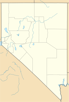
Grass Valley (Pershing and Humboldt counties, Nevada) facts for kids
Quick facts for kids Grass Valley |
|
|---|---|
| Length | 30 mi (48 km) WNW x SSE |
| Geography | |
| Country | United States |
| State | Nevada |
| Region | Great Basin |
| Counties | Pershing and Humboldt |
| Communities | Winnemucca, Rose Creek and Goldbanks (site) |
| Borders on | East Range, Winnemucca, Nevada, Sonoma Range and Tobin Range |
| River | Clear Creek (Sonoma Range) |
Grass Valley is a long valley located in northern Nevada, United States. It stretches across parts of Pershing and Humboldt counties. The valley is about 30 miles (48 km) long.
The northern part of Grass Valley is close to the city of Winnemucca, which sits on the Humboldt River. A stream called Clear Creek flows through the middle of the valley. It moves towards the north-northwest and eventually joins the Humboldt River near Rose Creek, Nevada. This meeting point is about 10 miles (16 km) southwest of Winnemucca.
A special area called Grass Valley is located in the center of the valley. This area is a census-designated place, which means it's a community that the government counts for population, but it's not an official city or town. About 1,161 people live there.
The valley got its name because it had a lot of grass, which was good for grazing animals.
What is Grass Valley Like?
Grass Valley runs in a north-northwest direction. It is tucked between two mountain ranges that are south of the Humboldt River. To the southwest, you'll find the East Range. To the north-northeast, there's the Sonoma Range.
The valley gets narrower at its southern end. Here, the northern hills of the Tobin Range meet up with the Sonoma Range.
The widest part of the valley is in its center, measuring about 9 miles (14 km) across. Clear Creek enters the valley from the northeast, just north of the center. This creek gets its water from the main mountain area, or massif, of the Sonoma Range, specifically from Sonoma Peak, which is 9,395 feet (2,864 meters) tall.
The valley becomes narrower, about 4 miles (6.4 km) wide, as you go north and south. However, it widens again where it meets the flat, low-lying land next to the Humboldt River, known as the floodplain. The very center of the valley is located southwest of Clear Creek Ranch, near the western base of the Sonoma Range mountains.
How to Get to Grass Valley
The northern part of Grass Valley can be reached by Nevada State Route 294. This road is paved for about 5 miles (8 km) into the valley. After that, it becomes an unpaved road called Grass Valley Road.
Grass Valley Road continues through the center-east part of the valley, close to the foothills of the mountains. About 25 miles (40 km) further, it reaches a place called Goldbanks (site) at the southern end of Grass Valley. This area is in the northwest part of the Tobin Range. Grass Valley Road then keeps going south through Paradise Valley before entering the northern part of Dixie Valley in Churchill County.
 | Ernest Everett Just |
 | Mary Jackson |
 | Emmett Chappelle |
 | Marie Maynard Daly |


