Grasshopper Junction, Arizona facts for kids
Quick facts for kids
Grasshopper Junction, Arizona
|
|
|---|---|
| Country | United States |
| State | Arizona |
| County | Mohave |
| Elevation | 3,547 ft (1,081 m) |
| Time zone | UTC-7 (MST) |
| ZIP codes |
86401
|
| Area code(s) | 928 |
| GNIS feature ID | 24437 |
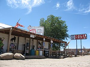
Grasshopper Junction is a small, undeveloped place in Mohave County, Arizona, United States. It's called an unincorporated community because it doesn't have its own local government like a city or town.
This area is about four miles (6 km) west of Chloride. Grasshopper Junction is known for its restaurant, which is a popular stop for travelers. It also offers a way to reach an old mining camp nearby.
Contents
A Look at Grasshopper Junction's Past
Nuclear Tests Nearby
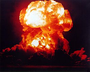
In 1951, the United States government created the Nevada Test Site. This was a special area in Nevada where they tested nuclear weapons. It was about 180 miles (290 km) northwest of Grasshopper Junction.
During the 1950s, people could see the huge mushroom clouds from these tests. They were visible for almost 100 miles (160 km) away! Even in Las Vegas, these tests became a kind of tourist attraction.
Between 1957 and 1958, two important series of tests happened. They were called Operation Plumbbob and Operation Hardtack II. Because Grasshopper Junction was relatively close, it was mentioned in government discussions about these tests in 1959. At that time, only two people lived in Grasshopper Junction.

Honoring Chloride's History
In December 1975, a special marker was put up near Grasshopper Junction. This marker was placed to celebrate the 200th birthday of the nearby town of Chloride.
Community Life and Changes
From 1988 to 1991, Grasshopper Junction had a population of six people. This included Dean Morrison and Jackie Appelhans, who owned a local store and restaurant. Their four children also lived there, though they later moved away.
In July 2005, a large wildfire called the Twin Mills wildfire affected Grasshopper Junction. This fire was started by lightning and burned over 10,600 acres (43 km²). Firefighters used air drops of flame retardant to protect the community.
Water Beneath the Ground
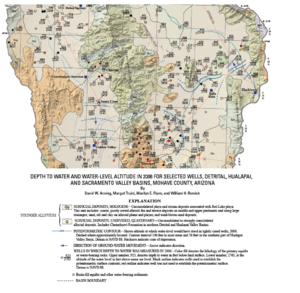
A 2006 study by the United States Geological Survey looked at the water underground in Grasshopper Junction. They found that the ground water is about 11 feet (3.4 m) below the surface. This water is part of a larger underground water system called a basin-fill aquifer. The water flows slowly towards the south.
Other Nearby Places
- Santa Claus, Arizona, a unique town located just south of Grasshopper Junction.
 | Precious Adams |
 | Lauren Anderson |
 | Janet Collins |


