Greenwald, Minnesota facts for kids
Quick facts for kids
Greenwald
|
|
|---|---|

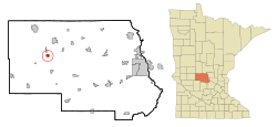
Location of Greenwald
within Stearns County, Minnesota |
|
| Country | United States |
| State | Minnesota |
| County | Stearns |
| Area | |
| • Total | 0.71 sq mi (1.85 km2) |
| • Land | 0.71 sq mi (1.85 km2) |
| • Water | 0.00 sq mi (0.00 km2) |
| Elevation | 1,266 ft (386 m) |
| Population
(2020)
|
|
| • Total | 197 |
| • Density | 276.30/sq mi (106.72/km2) |
| Time zone | UTC-6 (Central (CST)) |
| • Summer (DST) | UTC-5 (CDT) |
| ZIP code |
56335
|
| Area code(s) | 320 |
| FIPS code | 27-25874 |
| GNIS feature ID | 2394998 |
Greenwald is a small city in Stearns County, Minnesota, United States. In 2020, about 197 people lived there. It's part of the larger St. Cloud area.
You can reach Greenwald using Minnesota State Highway 4. Also, Interstate 94 is not far away.
Contents
The Story of Greenwald
Greenwald got its own post office in 1910. The name "Greenwald" has German roots. The word wald means "forest" in German.
Where is Greenwald?
Greenwald is a small place, covering about 1.85 square kilometers (0.71 square miles). All of this area is land.
Even though Greenwald is its own city, it is located inside Grove Township.
Who Lives in Greenwald?
Here's how Greenwald's population has changed over the years:
| Historical population | |||
|---|---|---|---|
| Census | Pop. | %± | |
| 1920 | 153 | — | |
| 1930 | 237 | 54.9% | |
| 1940 | 233 | −1.7% | |
| 1950 | 207 | −11.2% | |
| 1960 | 266 | 28.5% | |
| 1970 | 244 | −8.3% | |
| 1980 | 259 | 6.1% | |
| 1990 | 209 | −19.3% | |
| 2000 | 201 | −3.8% | |
| 2010 | 222 | 10.4% | |
| 2020 | 197 | −11.3% | |
| U.S. Decennial Census | |||
Greenwald's Population in 2010
In 2010, there were 222 people living in Greenwald. They lived in 98 different homes. Most people were White, making up 100% of the population. A small number, about 0.9%, were Hispanic or Latino.
The average age of people in Greenwald was about 51 years old. About 21% of the residents were under 18. About 22% were 65 years old or older. The city had slightly more males (52.7%) than females (47.3%).
See also
 In Spanish: Greenwald (Minnesota) para niños

