Grindstone Mountain (Nevada) facts for kids
Quick facts for kids Grindstone Mountain |
|
|---|---|

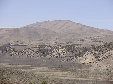
Grindstone Mountain, with the South Fork Humboldt River in the foreground
|
|
| Highest point | |
| Elevation | 7,382 ft (2,250 m) NAVD 88 |
| Prominence | 1,197 ft (365 m) |
| Geography | |
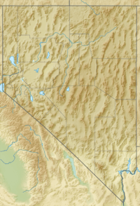
| Location | Elko County, Nevada, U.S. |
| Parent range | Elko Hills |
| Topo map | USGS Grindstone Mountain |
| Climbing | |
| Easiest route | A dirt road (high clearance required) leads northwest from Bullion Road (Elko County Route 720) to radio facilities on the summit |
Grindstone Mountain is a cool mountain located in Elko County, Nevada, in the United States. It's part of a group of mountains called the Elko Hills. This mountain stands tall and has some important equipment at its very top!
Contents
About Grindstone Mountain
Grindstone Mountain reaches an elevation of 7,382 feet (about 2,250 meters) above sea level. That's pretty high! It's a noticeable peak within the Elko Hills range.
Where is Grindstone Mountain?
This mountain is found in the northeastern part of Nevada. Specifically, it's located in Elko County, which is a large county known for its wide-open spaces and beautiful natural landscapes.
What's on Top of the Mountain?
If you were to reach the very top of Grindstone Mountain, you would see several radio towers. These towers are super important because they help send and receive signals for things like cell phones, television, and other communication systems. They help people stay connected across long distances!
Getting to the summit isn't too hard if you have the right vehicle. There's a dirt road that leads up to the radio facilities. You'd need a car with high clearance, meaning it sits higher off the ground, to drive on this kind of road.
Amazing Views from the Summit
From the top of Grindstone Mountain, you can see incredible views all around! It's a fantastic spot to look out over the vast landscapes of Nevada. You can see other mountains, valleys, and the wide-open sky. It's a perfect place to take in a 360-degree panorama.
 | Sharif Bey |
 | Hale Woodruff |
 | Richmond Barthé |
 | Purvis Young |


