Grover, North Carolina facts for kids
Quick facts for kids
Grover, North Carolina
|
|
|---|---|

Location of Grover, North Carolina
|
|
| Country | United States |
| State | North Carolina |
| County | Cleveland |
| Area | |
| • Total | 0.98 sq mi (2.55 km2) |
| • Land | 0.96 sq mi (2.47 km2) |
| • Water | 0.03 sq mi (0.08 km2) |
| Elevation | 860 ft (260 m) |
| Population
(2020)
|
|
| • Total | 802 |
| • Density | 838.91/sq mi (324.06/km2) |
| Time zone | UTC-5 (Eastern (EST)) |
| • Summer (DST) | UTC-4 (EDT) |
| ZIP code |
28073
|
| Area code(s) | 704 |
| FIPS code | 37-28400 |
| GNIS feature ID | 2406624 |
Grover is a small town in Cleveland County, North Carolina, United States. It is located right where the states of North Carolina and South Carolina meet. In 2020, about 802 people lived there.
Contents
History of Grover
Grover is a special town because major roads and railway lines cross the state border here. These include Interstate 85 and U.S. Route 29. The town was once called Whitaker. It was even legally part of South Carolina for a short time.
How Grover Got Its Name
In 1885, the town's name changed to Grover. This was done to honor President Grover Cleveland. He was the President of the United States at that time. The town wanted to get more attention by naming itself after him.
Railroad and Travel
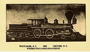
Grover became important because of the railroad. The Atlanta Charlotte Airline Railway built a special turntable there. This allowed train engines to turn around. Trains ran from the 1880s to the 1920s. Today, Norfolk Southern (formerly Southern Railway) still uses these tracks.
Amtrak also uses the line to carry passengers. You can travel from Atlanta to Charlotte, Richmond, Boston, and New York City. Even former President George W. Bush made a train stop in Grover during his election campaign.
Famous People and Places
Grover has been home to some interesting people. Hatcher Hughes lived here and won a Pulitzer Prize in 1924. He won it for his play Hell-Bent Fer Heaven. This play was about people from the foothills area, where Grover is located. He was also a professor at Columbia University.
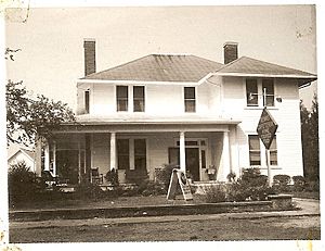
The Hambright family, who built a large mansion in 1879, also lived in Grover. This mansion is now called The Inn of the Patriots. A former White House Chef, Martin CJ Mongiello, also lives in Grover. He used to manage Camp David, a special resort for presidents.
Grover and Cleveland County
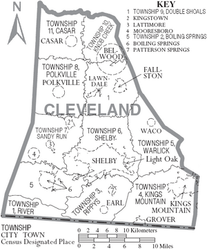
Grover is part of Cleveland County, North Carolina. The county is named after Colonel Benjamin Cleveland. He was a hero in the Revolutionary War. He fought alongside Colonel Frederick Hambright in the Battle of King's Mountain.
Grover has many official historical markers. These markers tell important stories about the town's past. The British army, led by Lord Charles Cornwallis, entered North Carolina through Grover during the Revolutionary War.
In 1887, the county's name changed from "Cleaveland" to "Cleveland." This was to match the more common spelling. It also happened shortly after President Grover Cleveland married in the White House. This event brought a lot of news attention.
Cleveland Avenue (Route 226) runs through Grover. The Shiloh Presbyterian Church, built in 1905, is next to Doctor Alfred Hambright's old home. In 2008, a statue was dedicated to Colonel Frederick Hambright and US Marine Corporal Clyde Furman Horton. The Shiloh Presbyterian Church Cemetery is also a historic site.
Grover is working to bring back its old-fashioned look and feel. The town wants to highlight its history, especially its railroad past. The current mayor is Bill Willis.
Geography
Grover covers about 1.0 square mile (2.55 square kilometers). Most of this area is land. A small part, about 0.04 square miles (0.08 square kilometers), is water.
Population and People
Grover has grown over the years. Here's how the population has changed:
| Historical population | |||
|---|---|---|---|
| Census | Pop. | %± | |
| 1890 | 126 | — | |
| 1900 | 174 | 38.1% | |
| 1910 | 209 | 20.1% | |
| 1920 | 296 | 41.6% | |
| 1930 | 435 | 47.0% | |
| 1940 | 469 | 7.8% | |
| 1950 | 535 | 14.1% | |
| 1960 | 538 | 0.6% | |
| 1970 | 555 | 3.2% | |
| 1980 | 597 | 7.6% | |
| 1990 | 516 | −13.6% | |
| 2000 | 698 | 35.3% | |
| 2010 | 708 | 1.4% | |
| 2020 | 802 | 13.3% | |
| 2022 (est.) | 808 | 14.1% | |
| U.S. Decennial Census | |||
2020 Census Information
In 2020, there were 802 people living in Grover. There were 272 households and 187 families.
| Race | Number | Percentage |
|---|---|---|
| White (non-Hispanic) | 622 | 77.56% |
| Black or African American (non-Hispanic) | 86 | 10.72% |
| Native American | 1 | 0.12% |
| Asian | 16 | 2.0% |
| Pacific Islander | 1 | 0.12% |
| Other/Mixed | 49 | 6.11% |
| Hispanic or Latino | 27 | 3.37% |
Transportation
Grover is easy to reach by road.
 I-85 has exits that serve the town. There is a welcome center nearby. Grover is right on the state line.
 US 29 runs through the downtown area. It goes alongside the railroad tracks and Main Street.
Education
Grover has one public elementary school, Grover Elementary. For middle and high school, students usually go to schools in nearby Kings Mountain, NC. Kings Mountain High School is a large school in the area.
See also
 In Spanish: Grover (Carolina del Norte) para niños
 | Charles R. Drew |
 | Benjamin Banneker |
 | Jane C. Wright |
 | Roger Arliner Young |


