Growler Mountains facts for kids
Quick facts for kids Growler Mountains |
|
|---|---|

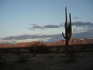
Looking east towards the Growler Mountains
|
|
| Highest point | |
| Peak | Unnamed |
| Elevation | 3,294 ft (1,004 m) |
| Dimensions | |
| Length | 23 mi (37 km) N-S |
| Width | 6 mi (9.7 km) |
| Geography | |
| Country | United States |
| Settlement | Ajo, AZ |
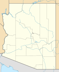
The Growler Mountains are a mountain range in western Pima County, Arizona. They stretch about 23 miles (37 km) from north to south. These mountains are located about 12 miles (19 km) west of Ajo, Arizona.
The Growler Mountains are part of the Sonoran Desert in southern Arizona. This area is one of the driest deserts in North America.
The tallest point in the range is an unnamed peak in the south, reaching 3,294 feet (1,004 meters) high. Growler Peak is another important peak, found at the north end of the range, standing 3,029 feet (923 meters) tall.
The Growler Mountains sit on a special "water divide." This means they separate the land where water flows in two different directions. Water from the west side of the range flows into Growler Valley. This water eventually reaches the San Cristobal Wash.
Water from the north side of the range flows into Childs Valley. This valley is part of the Tenmile Wash Drainage. Both of these washes eventually lead to the Gila River. The Gila River then flows west to join the Colorado River near Yuma, Arizona.
Exploring the Growler Mountains and Nearby Areas
The Growler Mountains are located in the eastern part of the Cabeza Prieta National Wildlife Refuge. This refuge is a protected area for wildlife. The southern edge of the mountains touches the northern border of Organ Pipe Cactus National Monument.
Organ Pipe Cactus National Monument
This monument is famous for its beautiful scenery. It's also known for its amazing wildflowers that bloom after wet winters. The monument is named after the unique Organ Pipe Cactus that grows there.
Getting to the Mountains
The center of the Growler Mountains is about 12 miles (19 km) west of Ajo, Arizona. You can reach Ajo by taking State Route 85. The northern part of the range is about 40 miles (64 km) south of Sentinel, Arizona. Sentinel is located on Interstate 8.
To reach the mountains from Sentinel, you would need to use unpaved dirt roads. Traveling on dirt roads in the summer can be dangerous. This is because of the very high temperatures and lack of water in the desert.
The exact location of the Growler Mountains is 32.2428 degrees North latitude and 113.0279 degrees West longitude.
 | Valerie Thomas |
 | Frederick McKinley Jones |
 | George Edward Alcorn Jr. |
 | Thomas Mensah |


