Guanajibo, Hormigueros, Puerto Rico facts for kids
Quick facts for kids
Guanajibo
|
|
|---|---|
|
Barrio
|
|

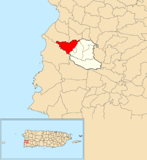
Location of Guanajibo within the municipality of Hormigueros shown in red
|
|
| Commonwealth | |
| Municipality | |
| Area | |
| • Total | 2.33 sq mi (6.0 km2) |
| • Land | 2.33 sq mi (6.0 km2) |
| • Water | 0 sq mi (0 km2) |
| Elevation | 151 ft (46 m) |
| Population
(2010)
|
|
| • Total | 5,959 |
| • Density | 2,557.5/sq mi (987.5/km2) |
| Source: 2010 Census | |
| Time zone | UTC−4 (AST) |
| ZIP Code |
00660
|
Guanajibo is a neighborhood, also called a barrio, located in the town of Hormigueros, Puerto Rico. In 2010, about 5,959 people lived there.
A Look at Guanajibo's Past
After the Spanish–American War, Puerto Rico was given to the United States by Spain. This happened under an agreement called the Treaty of Paris of 1898. Puerto Rico then became an unincorporated territory of the United States. This means it's part of the U.S. but not a state.
In 1899, the United States Department of War counted the people in Puerto Rico. This count is called a census. They found that Guanajibo and a nearby area called Pueblo had a combined population of 1,203 people.
The number of people living in Guanajibo has changed over the years:
| Historical population | |||
|---|---|---|---|
| Census | Pop. | %± | |
| 1910 | 896 | — | |
| 1920 | 1,004 | 12.1% | |
| 1930 | 1,050 | 4.6% | |
| 1940 | 1,329 | 26.6% | |
| 1950 | 1,729 | 30.1% | |
| 1980 | 6,103 | — | |
| 1990 | 6,244 | 2.3% | |
| 2000 | 6,437 | 3.1% | |
| 2010 | 5,959 | −7.4% | |
| U.S. Decennial Census 1899 (shown as 1900) 1910-1930 1930-1950 1980-2000 2010 |
|||
Parts of Guanajibo: Sectors
In Puerto Rico, barrios like Guanajibo are often divided into even smaller areas. These smaller areas are called sectores (which means sectors in English).
Sectors can have different names, like urbanización (a type of housing development), reparto (a land division), barriada (a neighborhood), or residencial (a residential area).
Here are some of the sectors you can find in Guanajibo barrio:
Calle La Ceiba, Camino Cachito, Camino Fian Toro, Camino Justo Colón, Camino Los Barbosa, Carretera 343 (until km 2.3), Égida Presbiteriana del Ángel, Hogar Eterno Paraíso de Amor, Hogar San José, Parcelas San Romualdo, Reparto Santa Ana, Sector Higinia Vázquez, Sector Hoya Grande, Sector Las Plumas, Sector Los Quiles, Sector Los Santana (both sides), Sector Punto Cubano, Urbanización Buenaventura, Urbanización Paseo Loma Linda, Urbanización Monte Bello, Urbanización Valle Hermoso, and Urbanización Villa Zoraida.
See Also
 In Spanish: Guanajibo (Hormigueros) para niños
- List of communities in Puerto Rico
- List of barrios and sectors of Hormigueros, Puerto Rico


