Guilderland Center, New York facts for kids
Quick facts for kids
Guilderland Center
|
|
|---|---|
| Etymology: For being roughly in the geographic center of the town of Guilderland | |
| Country | United States |
| State | New York |
| Region | Capital District |
| County | Albany |
| Settled | 1790s |
| Time zone | UTC-5 (EST) |
| • Summer (DST) | UTC-4 (EDT) |
| ZIP Code |
12085
|
| Area code(s) | 518 |
Guilderland Center is a small community, called a hamlet, located in the town of Guilderland, New York. It's found in Albany County, which is part of New York State. This hamlet sits along a road called New York Route 146 and next to a stream known as Black Creek. Black Creek is a smaller stream that flows into a larger one called Normans Kill.
Contents
History of Guilderland Center
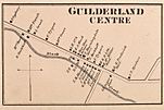
Guilderland Center grew around factories that were built at a place once known as French's Mills. The very first factory was set up in 1795 by Peter Broeck. The name French's Mills, sometimes called French's Hollow, came from Abel French. He built his own mill there in 1800.
Most of French's Hollow and its mills were destroyed in 1916. This happened when the Black Creek was dammed to create the Watervliet Reservoir. Abel French's Mill was taken down, and a pumping station was built in its place.
Locals originally called Guilderland Center by a different name: Bang-all. This name came from the area's reputation for rough behavior. Around 1803, when the town of Guilderland was officially formed, the name Guilderland Center started to become popular. When a post office was opened, it also took the name Guilderland Center. By 1866, about 450 people lived in the hamlet.
In 1860, the District Number 6 Cobblestone School was built in Guilderland Center. This building stopped being used as a school in 1941. However, the Guilderland Central School District still owns it. The school building is now listed on the National Register of Historic Places. This means it's recognized as an important historical site.
Geography of Guilderland Center
Since Guilderland Center is a hamlet, its exact boundaries are not officially set. Generally, it's considered to be along New York Route 146. This area stretches from Van Buren Boulevard west to Hurst Road. It also includes nearby areas along School Road and Depot Road, up to where they meet. The entire lengths of Hurst and French Mill roads are also part of Guilderland Center.
Guilderland Center is located south of the Watervliet Reservoir. It lies along the Black Creek, which is a significant local waterway.
Where is Guilderland Center?
 |
Watervliet Reservoir |  |
||
| Village of Altamont | Hamlet of Guilderland | |||
| Town of New Scotland Village of Voorheesville |
Important Places in Guilderland Center
Guilderland Center has several important locations and landmarks:
- Centerpointe Community Church
- Helderberg Reformed Dutch Church – This church is listed on the National Register of Historic Places.
- St. Mark's Lutheran Church – This church is also on the National Register of Historic Places.
- Frederick Crouse House – This historic house is on the National Register of Historic Places.
- Guilderland Center Nursing Home
- Northeastern Industrial Park
- French's Hollow Fairways – A place for golf.
- Keenholts Park – A local park for recreation.
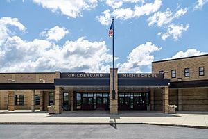
- Guilderland High School – The main high school for the area.
- Park Guilderland Shopping Center – A place for shopping.
- Town of Guilderland Landfill
 | John T. Biggers |
 | Thomas Blackshear |
 | Mark Bradford |
 | Beverly Buchanan |


