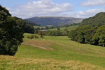
Gyrn Moelfre is a mountain located in Powys, a county in mid Wales. It stands close to the border with Shropshire, which is in England. This mountain is found to the south-east of the Berwyn Mountains. A river called Afon Ysgwennant separates Gyrn Moelfre from the main Berwyn range. The small village of Llansilin is nestled on its south-west slopes. Historically, this area was part of Denbighshire, but the county borders changed in 1996, moving it to Powys.
What is Gyrn Moelfre?
Gyrn Moelfre is a mountain that reaches 523 meters (about 1,716 feet) high. It's considered a "Marilyn," which is a special term for a hill or mountain in the British Isles that rises at least 150 meters (about 492 feet) above the land around it. This means it stands out quite a bit from its surroundings!
A Place for Adventure
Did you know that Gyrn Moelfre is also a popular spot for exciting sports? In recent years, this mountain has become a well-known location for mountain biking. It has even hosted the British Downhill Series. This is a big competition where skilled mountain bikers race down the steep slopes as fast as they can. Other smaller downhill biking events also take place here, making it a hub for outdoor adventure.


