Ha-Iltzuk Icefield facts for kids
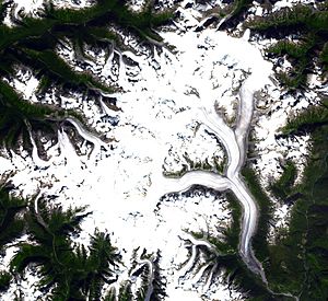
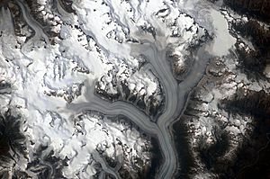
The Ha-Iltzuk Icefield is a massive area of ice and snow. It is found in the Coast Mountains of British Columbia, Canada. This icefield is the biggest one in the Coast Mountains south of the Alaska Panhandle. It covers a huge area of about 3,610 km2 (1,390 sq mi). That's like many cities put together!
Contents
What is the Ha-Iltzuk Icefield?
An icefield is a large area of connected glaciers. These glaciers flow out from a central ice mass. The Ha-Iltzuk Icefield is a great example of this. It's a frozen wonderland with many glaciers.
Where is this Giant Icefield?
The Ha-Iltzuk Icefield is located in the central Pacific Ranges. These are part of the larger Coast Mountains. It sits on the west side of the Klinaklini River. It is also near the Waddington Range. This area is known for its tall, rugged mountains.
Mountains and Volcanoes
The highest point in the icefield is Mount Silverthrone. This mountain is on the edge of a special geological feature. It's a large, circular area called the Silverthrone Caldera. A caldera is a big bowl-shaped hollow. It forms when a volcano collapses after a huge eruption. This caldera is about 20 km (12 mi) wide. It has been deeply carved out by ice over time.
Glaciers and Rivers
The southern part of the icefield is called the Silverthrone Glacier. This glacier flows towards the west. It joins another large glacier, the Klinaklini Glacier. The Klinaklini Glacier is the northern half of the icefield. A lot of water flows out from the Silverthrone Glacier. This water quickly joins the Klinaklini River. From the northwest side of the Klinaklini Glacier, another tongue of ice creates the start of the Machmell River.
What's in a Name?
You might not find the name "Ha-Iltzuk Icefield" in official government records. The name is very likely a way of writing "hailtzaq". This is how the Heiltsuk people say "Heiltsuk" in their own language. The Heiltsuk are an Indigenous group from this region.
 | Madam C. J. Walker |
 | Janet Emerson Bashen |
 | Annie Turnbo Malone |
 | Maggie L. Walker |


