
Hackberry, Arizona facts for kids
Quick facts for kids
Hackberry, Arizona
|
|
|---|---|

Welcome to Hackberry
|
|

Location in Mohave County, Arizona
|
|

Hackberry, Arizona
Location in Arizona

Hackberry, Arizona
Location in the United States
|
|
| Country | United States |
| State | Arizona |
| County | Mohave |
| Founded | 1874 |
| Area | |
| • Total | 17.59 sq mi (45.56 km2) |
| • Land | 17.59 sq mi (45.56 km2) |
| • Water | 0.00 sq mi (0.00 km2) |
| Elevation | 3,583 ft (1,092 m) |
| Population
(2020)
|
|
| • Total | 103 |
| • Density | 5.9/sq mi (2.26/km2) |
| Time zone | UTC-7 (Mountain (MST)) |
| ZIP code |
86411
|
| Area code(s) | 928 |
| GNIS feature ID | 5466 |
| FIPS code | 04-30830 |
Hackberry is a small community in Mohave County, Arizona, in the United States. It's located on the famous Arizona State Route 66 (which used to be U.S. Route 66), about 28 miles (45 km) northeast of Kingman. Hackberry has a post office, and in 2015, it served 68 homes. In 2020, about 103 people lived there.
Contents
A Look at Hackberry's Past
Hackberry used to be a mining town. It got its name from the Hackberry Mine, which was named after a hackberry tree growing near a spring.
Early Mining Days
A prospector named Jim Music helped start the Hackberry Silver Mine in 1875. The town grew because of mining different metals. It would have "boom" times when prices were high and "bust" times when prices dropped.
In 1886, a newspaper article mentioned J.J. Watts, a miner from Hackberry. He wrote that books he loaned out helped change people's minds. He wished more people could read such books.
Later, in 1909, another article talked about J.J. Watts. People thought he might have been killed by Native Americans in the Wallapai mountains. But it turned out he had died in Wyoming. The person killed was a stranger who had been tricked by a story of a lost mine.
From Mining to Ghost Town
By 1919, the mine was running out of ore, and the owners were having arguments. The mine closed, and Hackberry almost became a ghost town.
Route 66 and Beyond
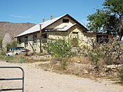
When U.S. Route 66 came through town in 1926, Hackberry became busy again. Many gas stations and shops opened to serve travelers. John Grigg ran a Union 76 gas station from the 1920s until 1967. The Northside Grocery and its Conoco station were among the last to close in 1978.
However, when Interstate 40 was built, it bypassed Hackberry. This new highway was 16 miles away, and Hackberry was left off the main route. The town almost became a ghost town for a second time.
But the Grigg family, who have lived in Hackberry since the 1890s, helped keep the community alive. Six generations of their family are buried in the local cemetery.
The Hackberry General Store
In 1992, an artist named Bob Waldmire reopened the Hackberry General Store. It became a popular spot for Route 66 tourists, offering information and souvenirs.
In 1998, Waldmire sold the store to John and Kerry Pritchard. This happened because of disagreements about stone quarries opening nearby. These quarries were digging up local stone for landscaping.
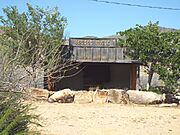
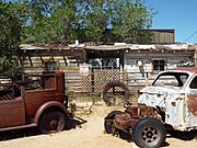
Today, the Hackberry General Store is still open. It has a cool collection of vintage cars from when Route 66 was at its busiest. In 2008, the store owners even donated land for a new fire station for the community.
Where is Hackberry?
Hackberry is located in the eastern part of Mohave County. It's along Arizona State Route 66, about 28 miles (45 km) northeast of Kingman, which is the county seat. It's also 60 miles (97 km) west of Seligman. Hackberry Road goes south from the town, leading 21 miles (34 km) to U.S. Route 93.
The area of Hackberry is about 17.6 square miles (45.56 km²), and it's all land. The town sits at the western end of Truxton Canyon. Truxton Wash flows northwest into the Hualapai Valley, ending at Red Lake, which is 27 miles (43 km) from Hackberry.
Learning in Hackberry
Most of the community is part of the Hackberry School District. A small part of the community is in the Valentine Elementary School District.
Population Facts
In 2010, the population of Hackberry was 68 people. By 2020, it had grown to 103 people.
Gallery

-
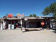
Hackberry General Store
-
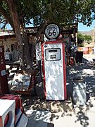
Mobilgas fuel pump
-
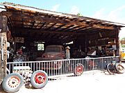
Hackberry Garage – 1934
-
Hackberry Shell station – 1934
-
Hackberry Music Hall
-
Hackberry Motel – 1935
-
Hackberry Café – 1920
-
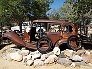
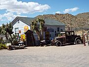
Automobile abandoned in Route 66
-
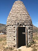
1920 charcoal kiln
-
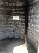
Inside the 1920 charcoal kiln


See also
 In Spanish: Hackberry (Arizona) para niños
