Hamersville, Ohio facts for kids
Quick facts for kids
Hamersville, Ohio
|
|
|---|---|
|
Village
|
|

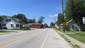
Looking northwest on Main Street (Ohio State Route 125) in Hamersville
|
|

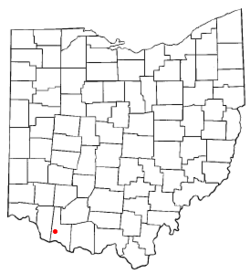
Location of Hamersville, Ohio
|
|

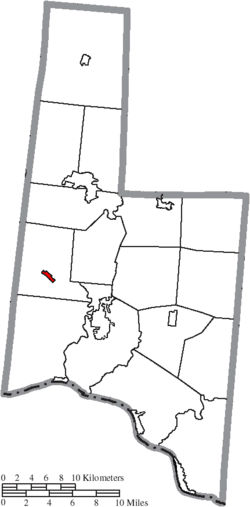
Location of Hamersville in Brown County
|
|
| Country | United States |
| State | Ohio |
| County | Brown |
| Township | Clark |
| Area | |
| • Total | 0.44 sq mi (1.13 km2) |
| • Land | 0.44 sq mi (1.13 km2) |
| • Water | 0.00 sq mi (0.00 km2) |
| Elevation | 968 ft (295 m) |
| Population
(2020)
|
|
| • Total | 485 |
| • Estimate
(2023)
|
487 |
| • Density | 1,107.31/sq mi (427.92/km2) |
| Time zone | UTC-5 (Eastern (EST)) |
| • Summer (DST) | UTC-4 (EDT) |
| ZIP code |
45130
|
| Area code(s) | 937, 326 |
| FIPS code | 39-32984 |
| GNIS feature ID | 2398230 |
Hamersville (/ˈheɪmərzvɪl/ hay-MƏRZ-vil) is a small village located in Clark Township, Brown County, Ohio, United States. It's a quiet community with a population of 485 people, according to the 2020 census.
Contents
A Look Back: Hamersville's History
Hamersville was founded a long time ago, in 1838. It was named after a very important person named Thomas L. Hamer. He was a congressman, which means he helped make laws for the country. Later, he became a general in the Mexican–American War, a war between the United States and Mexico.
Where is Hamersville? Geography and Location
Hamersville is located in the state of Ohio. The United States Census Bureau says the village covers a total area of about 0.39 square miles (1.01 square kilometers). All of this area is land, meaning there are no large bodies of water within the village limits.
Who Lives in Hamersville? Population and Demographics
| Historical population | |||
|---|---|---|---|
| Census | Pop. | %± | |
| 1880 | 231 | — | |
| 1890 | 264 | 14.3% | |
| 1900 | 242 | −8.3% | |
| 1910 | 276 | 14.0% | |
| 1920 | 235 | −14.9% | |
| 1930 | 267 | 13.6% | |
| 1940 | 349 | 30.7% | |
| 1950 | 380 | 8.9% | |
| 1960 | 524 | 37.9% | |
| 1970 | 567 | 8.2% | |
| 1980 | 688 | 21.3% | |
| 1990 | 586 | −14.8% | |
| 2000 | 515 | −12.1% | |
| 2010 | 546 | 6.0% | |
| 2020 | 485 | −11.2% | |
| 2023 (est.) | 487 | −10.8% | |
| U.S. Decennial Census | |||
Hamersville's Population in 2010
Based on the census from 2010, there were 546 people living in Hamersville. These people lived in 188 different households, and 143 of these were families. The village had about 1,400 people per square mile (540 people per square kilometer).
Most people in Hamersville were White (98.2%). A small number were Asian (0.2%), or from other races (0.5%). About 1.1% of residents identified with two or more races. Less than 1% of the population was Hispanic or Latino.
Households and Families
Out of the 188 households, 43.6% had children under 18 living there. About 54.8% were married couples living together. Some households (15.4%) had a female head with no husband present. A smaller number (5.9%) had a male head with no wife present. About 23.9% of households were not families.
The average household had 2.90 people. The average family had 3.27 people. About 19.1% of all households were made up of just one person. Around 7.5% of households had someone aged 65 or older living alone.
Age Groups in Hamersville
The average age in Hamersville was 34.5 years old. Here's a breakdown of the age groups:
- 29.3% of residents were under 18 years old.
- 8.6% were between 18 and 24 years old.
- 29.3% were between 25 and 44 years old.
- 22.9% were between 45 and 64 years old.
- 9.9% were 65 years of age or older.
The population was evenly split between genders, with 50.0% male and 50.0% female residents.
Famous Faces: Notable Person from Hamersville
- Albert Nelson Marquis: He was the person who started Who's Who. This is a famous collection of books that lists important people and their achievements.
See also
 In Spanish: Hamersville (Ohio) para niños
 | Aurelia Browder |
 | Nannie Helen Burroughs |
 | Michelle Alexander |


