Hamilton Inlet facts for kids
Quick facts for kids Hamilton Inlet |
|
|---|---|

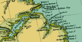
A map of the Lake Melville/Hamilton Inlet/Groswater Bay system, showing Hamilton Inlet as inclusive of L. Melville
|
|
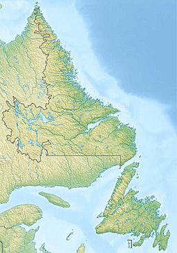
| Location | south central Labrador, between Lake Melville and Groswater Bay |
| Coordinates | 54°17′39″N 57°53′56″W / 54.29417°N 57.89889°W |
| Basin countries | Canada |
Hamilton Inlet is a large body of water in Labrador, a part of Newfoundland and Labrador, Canada. It's like a long, narrow arm of the sea, similar to a fjord. This inlet connects to Groswater Bay and stretches far inland.
Together with Lake Melville, Hamilton Inlet forms the biggest estuary in the province. An estuary is where a river meets the sea, mixing fresh and salt water. This large water system goes about 140 kilometers (87 miles) inland. It reaches all the way to Happy Valley-Goose Bay.
The main rivers that flow into Hamilton Inlet are the Churchill River and the Naskaupi River. These rivers bring water from a large area called a watershed. Lake Melville is usually seen as part of Hamilton Inlet. It extends west from a deep, narrow passage near the community of Rigolet.
Names of Hamilton Inlet
Hamilton Inlet got its current name to honor Charles Hamilton. He was a commodore-governor of Newfoundland in the early 1800s. The Churchill River, which flows into the inlet, was also once named after him.
Over time, this area has had other names too. It was known as Ivucktoke in the Inuttitut language, which means Aivitok. It was also called Eskimo Bay or Esquimaux Bay. In French, this was Baie des Esquimaux, meaning "Bay of the Eskimos". Another old name was St Louis Bay (or Baie-St Louis in French).
History of Hamilton Inlet
In 1586, Hamilton Inlet was the site of an important event. Inuit people attacked an expedition led by John Davis. During this attack, two people from Davis's group were killed. Others were also injured.
See also
 In Spanish: Hamilton Inlet para niños
 | Toni Morrison |
 | Barack Obama |
 | Martin Luther King Jr. |
 | Ralph Bunche |


