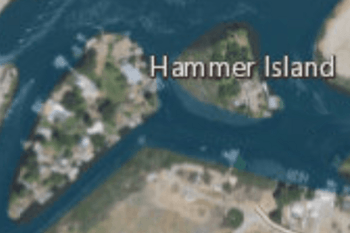
Hammer Island facts for kids

|
|
| Geography | |
|---|---|
| Location | Northern California |
| Coordinates | 37°48′59″N 121°33′25″W / 37.81639°N 121.55694°W |
| Adjacent bodies of water | Sacramento–San Joaquin River Delta |
| Highest elevation | 0 ft (0 m) |
| Administration | |
|
United States
|
|
| State | |
| County | Contra Costa |
Hammer Island is a small piece of land located in the Sacramento–San Joaquin River Delta in Northern California. It is part of Contra Costa County. This island is very flat, sitting at an elevation of 0 feet (0 meters) above sea level. Its elevation was officially measured by the United States Geological Survey in 1981.
Contents
About Hammer Island
Hammer Island is a small island within the large network of waterways that make up the Sacramento–San Joaquin River Delta. It is found in the western part of this delta region. The island's exact location can be pinpointed using its coordinates: 37°48′59″N 121°33′25″W / 37.81639°N 121.55694°W.
Location and Geography
Hammer Island is situated in Contra Costa County, which is one of the counties in the San Francisco Bay Area. The island is surrounded by water channels that are part of the delta system. To its west is the Mendota Canal, and to its east is the Old River. These waterways are important for moving water through California.
The island's low elevation means it is very close to the water level. This is common for many islands in the Sacramento–San Joaquin River Delta. The delta itself is a unique area where two major rivers, the Sacramento and San Joaquin, meet before flowing into San Francisco Bay.
The Sacramento–San Joaquin River Delta
Hammer Island is just one small part of the much larger Sacramento–San Joaquin River Delta. This delta is a huge area of wetlands and waterways. It covers about 1,100 square miles (2,800 square kilometers). The delta is formed where the Sacramento River from the north and the San Joaquin River from the south come together.
Importance of the Delta
The Sacramento–San Joaquin River Delta is very important for California. It provides a lot of the state's drinking water and water for farms. Many different kinds of plants and animals also live in the delta. It is a vital habitat for fish, birds, and other wildlife. The delta's complex system of islands, channels, and levees makes it a unique natural area.


