Hardesty, Oklahoma facts for kids
Quick facts for kids
Hardesty, Oklahoma
|
|
|---|---|

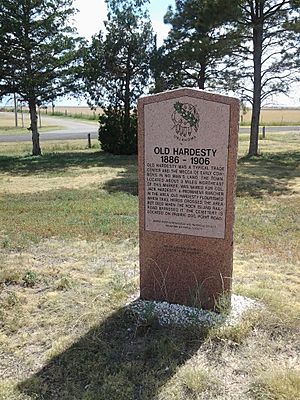
Historic marker on the western edge of Hardesty
|
|

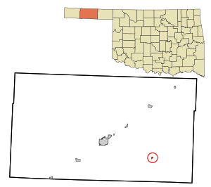
Location in Texas County and state of Oklahoma.
|
|
| Country | United States |
| State | Oklahoma |
| County | Texas |
| Area | |
| • Total | 0.23 sq mi (0.58 km2) |
| • Land | 0.23 sq mi (0.58 km2) |
| • Water | 0.00 sq mi (0.00 km2) |
| Elevation | 2,907 ft (886 m) |
| Population
(2020)
|
|
| • Total | 205 |
| • Density | 911.11/sq mi (352.22/km2) |
| Time zone | UTC-6 (Central (CST)) |
| • Summer (DST) | UTC-5 (CDT) |
| ZIP code |
73944
|
| Area code(s) | 580 |
| FIPS code | 40-32550 |
| GNIS feature ID | 1093528 |
Hardesty is a small town located in Texas County, Oklahoma, in the United States. It's a quiet place with a rich history. As of the 2020 census, about 205 people live there.
Contents
History of Hardesty
The story of Hardesty began in a slightly different spot. The first community named Hardesty was about four miles northeast of where the town is today. It even had its own post office starting in 1887. The town was named after A.J. "Jack" Hardesty, who had important business interests in the area.
However, in 1901, a big change happened. The Rock Island railroad built its tracks in a different location, bypassing the original Hardesty. This new railroad line led to the creation of Guymon, Oklahoma. Many people and businesses from Hardesty decided to move to Guymon, and the first Hardesty slowly faded away.
Years later, in 1929, another Rock Island railroad line was built. This time, it passed close to the old Hardesty site. Local people really wanted a new town there, so the community that grew along this new railroad was also named Hardesty. But this new town faced tough times. The Great Depression and the Dust Bowl made it hard for the town to grow.
Despite these challenges, Hardesty officially became an incorporated town in 1947. Today, it still has a post office and its own school district, which covers a large area of about 250 square miles.
Geography and Nature Around Hardesty
Hardesty is located in a unique natural area. It sits just south of the Coldwater Creek arm, which is part of the Optima Lake project. This area includes the Optima National Wildlife Refuge, a special place for animals and plants. There's also the Optima Wildlife Management Area, where people can go hunting. The Oklahoma Department of Wildlife Conservation manages these public lands.
The town is about 18 miles southeast of Guymon. You can reach Hardesty by traveling along Oklahoma State Highway 3, which is also known as U.S. Route 412 in this area.
Population Changes in Hardesty
The number of people living in Hardesty has changed over the years. Here's a look at the population from different census counts:
| Historical population | |||
|---|---|---|---|
| Census | Pop. | %± | |
| 1950 | 201 | — | |
| 1960 | 187 | −7.0% | |
| 1970 | 223 | 19.3% | |
| 1980 | 243 | 9.0% | |
| 1990 | 228 | −6.2% | |
| 2000 | 277 | 21.5% | |
| 2010 | 212 | −23.5% | |
| 2020 | 205 | −3.3% | |
| U.S. Decennial Census | |||
As of the census in 2000, there were 277 people living in Hardesty. The town had 102 households, with 74 of them being families. About 34.3% of the population was under 18 years old. The median age in the town was 28 years.
Education in Hardesty
Hardesty has its own school district that serves the local community. The district covers a wide area, providing education for students in the town and the surrounding rural areas.
See also
 In Spanish: Hardesty (Oklahoma) para niños
 | Janet Taylor Pickett |
 | Synthia Saint James |
 | Howardena Pindell |
 | Faith Ringgold |

