Harding Icefield facts for kids
Quick facts for kids Harding Icefield |
|
|---|---|

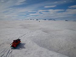
Harding Icefield between Bear and Skilak Glaciers, Nunatak Plateau in background
|
|
| Coordinates | 60°01′05″N 149°59′10″W / 60.0181°N 149.9861°W |
| Area | 700 square miles (1,800 km2) |
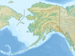
The Harding Icefield is a giant sheet of ice located in the Kenai Mountains of the Kenai Peninsula in Alaska. It's partly inside Kenai Fjords National Park. This amazing icefield is named after Warren G. Harding, who was a President of the United States.
Contents
Exploring the Harding Icefield
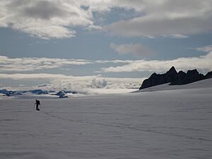
The Harding Icefield covers a huge area, more than 700 square miles (1,813 km2)! If you include all the glaciers that flow out from it, the total area is over 1,100 square miles (2,849 km2). This makes it one of the biggest icefields in the world.
Glaciers of the Icefield
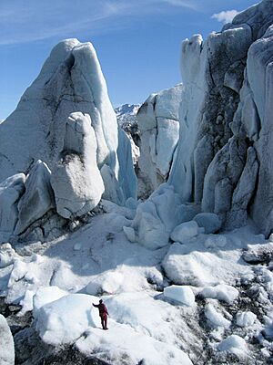
The icefield is like a giant frozen factory, creating up to 40 different glaciers. Some of the most famous ones are the Tustumena Glacier, Exit Glacier, and McCarty Glacier. The Exit Glacier is the easiest one to visit. You can reach it by a special road off the Seward Highway.
Snowfall and Size
The Harding Icefield is one of only four remaining icefields in the United States. It's also the largest one that is completely inside the U.S. Each year, this massive icefield gets over 400 inches of snow. That's a lot of snow!
History of the Harding Icefield
For a long time, people living in Seward didn't pay much attention to the huge icefield nearby. But in 1922, a new trail called the Spruce Creek trail was built. This trail let people see the upper parts of the icefield for the first time. It was named after President Harding because he promised to visit the area.
Early Explorers and Flights
By the mid-1920s and early 1930s, airplanes became more popular. This gave a few lucky people the chance to fly over the icefield and see its vastness from above. However, at this time, people had only walked on the edges of the icefield, not across it.
First Attempts to Cross
In 1936, a 27-year-old Swiss immigrant named Yule Kilcher arrived in Seward. He was so fascinated by the icefield that he decided he wanted to cross it. He tried to hike across, but the conditions were too difficult, and he had to turn back after a week.
Around 1940, two local men, Eugene "Coho" Smith and Don Rising, successfully crossed the icefield. They hiked from Bear Glacier to Tustumena Glacier. However, they didn't tell anyone about their trip, and it remained a secret for over 20 years!
The First Documented Crossing
In the spring of 1968, a group of ten mountaineers made the first officially recorded crossing of the Harding Icefield. They started at Chernof Glacier and hiked east to Exit Glacier. The expedition included some people who had tried before, like Yule Kilcher, Dave Johnston, Vin Hoeman, and Grace Hoeman.
Only four of the ten people hiked the entire way across the icefield: Bill Babcock, Dave Johnston, Yule Kilcher, and Vin Hoeman. They left Homer on April 17 and arrived in Seward eight days later. During their journey, they also made the first climb of Truuli Peak, a tall mountain that sticks out from the icefield.
Later Crossings
In 1983, Roman Dial and Jim Lokken skied from the edge of the Skilak Glacier to the Tustumena Glacier in just one day. The next year, in 1984, Roman Dial skied solo from the Skilak to the Chernof Glacier, also in one day, as part of a challenging event called the Alaska Mountain Wilderness Classic.
 | Kyle Baker |
 | Joseph Yoakum |
 | Laura Wheeler Waring |
 | Henry Ossawa Tanner |


