Hardy Monument facts for kids
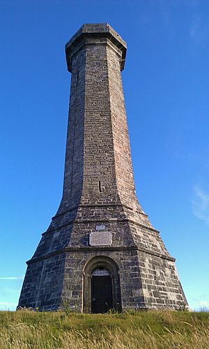
The Hardy Monument is a tall tower, about 72 feet (22 meters) high. It stands on top of Black Down hill in Dorset, England. People built it in 1844 to remember Vice Admiral Sir Thomas Hardy. He was a brave commander who fought in the famous Battle of Trafalgar.
Admiral Hardy lived nearby in a place called Portesham. His family owned a large area of land there, which included Black Down hill. They wanted the monument to be a helpful landmark for ships at sea. The monument has been on navigation maps since 1846. You can see it from as far as 60 miles (97 km) away on a clear day!
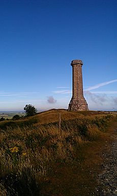
The monument is located on Black Down hill. This spot overlooks the English Channel near Portesham. In 1900, Admiral Hardy's family helped restore the monument. Later, in 1938, the National Trust bought it for £15.
Contents
Discover the Hardy Monument's Design
The Hardy Monument was designed to look like a spyglass. This is the kind of tool Admiral Hardy would have used on his ships. Its eight corners point towards the main compass directions. If you stand on the ground, the corner to the right of the lightning rod points exactly south. A special mark on the northwest side shows that Black Down hill is about 780 feet (238 meters) high here.
Amazing Views from the Top!
From the very top of the monument, you are about 850 feet (259 meters) above sea level. On a clear day, you can see a huge part of the coast! You might spot places from Start Point, Devon all the way to St. Catherine's Point on the Isle of Wight. Both of these are about 56 miles (90 km) away. Looking north, you can even see Pen Hill in the Mendip Hills, which is 38 miles (61 km) away.
The monument was closed for repairs in 2009. These important repairs finished in January 2012. Today, the monument is often open during busy times of the year. Visitors can climb the 120 steps to reach the amazing viewpoint at the top.
Exploring the Area Around the Monument
The open, wild area around the monument is called heathland. In 1984, this area was named a Site of Special Scientific Interest. This means the geology, or the rocks and landforms, in this spot are very rare and important.
Close to the monument, you'll find a stone bench. This seat was placed there to remember Lt Col William Digby Oswald. He was a soldier who sadly died in 1916 during a battle called the Somme.
The Ground Beneath Your Feet: Geology
Black Down hill is the very western end of what are called the Bagshot gravel beds. These gravel beds stretch a long way east, all the way to London!
The ground around the monument has many holes and dips. Many of these are called dolines or swallow holes. They form in a cool way: when rain falls on the very acidic topsoil. This water becomes even more acidic as it soaks through the soil. Then, it slowly dissolves the chalk rock underneath. Eventually, the topsoil above the empty spaces collapses, creating these bowl-shaped holes.
Dolines usually look like a teardrop cut in half and laid flat. Within 1,000 yards (914 meters) of the monument, there are three dolines that formed differently. They were created when chalk dissolved in a vertical crack in the rock. These dolines are like deep wells with straight sides. Two of them opened up in 1956 and are about 100 meters (328 feet) deep! Another one opened in 2006, and its depth is still unknown.
Mapping the Land: Geodesy
The Hardy Monument was once a very important point for map-making. It was the starting point (or "meridian") for the 6-inch and 1:2500 Ordnance Survey maps of Somerset and Dorset.


