Hartville, Ohio facts for kids
Quick facts for kids
Hartville, Ohio
|
|
|---|---|
|
Village
|
|

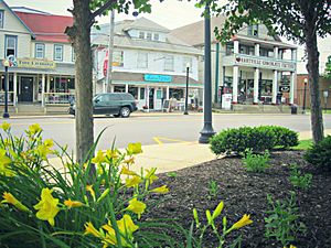
Downtown Hartville in the spring
|
|

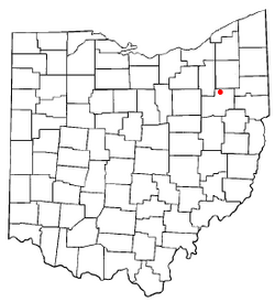
Location of Hartville, Ohio
|
|

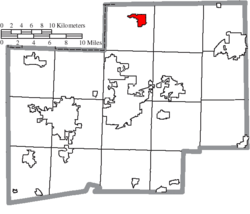
Location of Hartville in Stark County
|
|
| Country | United States |
| State | Ohio |
| County | Stark |
| Township | Lake |
| Area | |
| • Total | 2.70 sq mi (6.99 km2) |
| • Land | 2.70 sq mi (6.99 km2) |
| • Water | 0.00 sq mi (0.00 km2) |
| Elevation | 1,161 ft (354 m) |
| Population
(2020)
|
|
| • Total | 3,329 |
| • Estimate
(2023)
|
3,385 |
| • Density | 1,233.88/sq mi (476.38/km2) |
| Time zone | UTC-5 (Eastern (EST)) |
| • Summer (DST) | UTC-4 (EDT) |
| ZIP code |
44632
|
| Area code(s) | 330 |
| FIPS code | 39-34328 |
| GNIS feature ID | 2398260 |
Hartville is a small village located in northern Stark County, Ohio, in the United States. A village is a type of small town. In 2020, about 3,329 people lived there. Hartville is part of the larger Canton–Massillon metropolitan area, which means it's connected to the nearby cities of Canton and Massillon.
The village is located right in the middle of two bigger cities: Akron and Canton. You can find it where two main roads, State Route 43 and State Route 619, cross each other.
Contents
History of Hartville Village
Hartville was first settled by a person named John Morehart in 1818. The village was officially mapped out, or platted, in 1851. When a town is platted, its streets and land lots are drawn on a map.
The name "Hartville" probably comes from a mix of two last names: Morehart and another early settler named John Willis. Hartville officially became an incorporated village in 1951. This means it gained its own local government.
Geography of Hartville
Hartville is located in the state of Ohio. The United States Census Bureau is a government agency that collects information about people and places. According to them, the village covers a total area of about 2.58 square miles (6.68 square kilometers). All of this area is land, with no large bodies of water inside the village limits.
People Living in Hartville
The number of people living in Hartville has changed over the years. Here's how the population has grown:
| Historical population | |||
|---|---|---|---|
| Census | Pop. | %± | |
| 1880 | 135 | — | |
| 1960 | 1,353 | — | |
| 1970 | 1,752 | 29.5% | |
| 1980 | 1,772 | 1.1% | |
| 1990 | 2,031 | 14.6% | |
| 2000 | 2,174 | 7.0% | |
| 2010 | 2,944 | 35.4% | |
| 2020 | 3,329 | 13.1% | |
| 2023 (est.) | 3,385 | 15.0% | |
| U.S. Decennial Census | |||
Hartville's Population in 2020
In 2020, a census was taken. A census is an official count of a population. This count showed there were 3,329 people living in Hartville. The population density was about 1,160 people per square mile (448 people per square kilometer). This means how many people live in a certain area. There were 1,455 homes or housing units in the village.
Most of the people in Hartville were White (about 96.68%). There were also small numbers of Native American (0.72%), Asian (0.43%), and people of two or more races (2.17%). About 0.72% of the population identified as Hispanic or Latino.
There were 1,326 households in Hartville. A household is a group of people living together in one home.
- About 15.4% of these households had children under 18 years old.
- 42% were married couples living together.
- 15.73% had a female head of the household without a husband present.
- 3.6% had a male head of the household without a wife present.
- About 38.67% were non-families, meaning people living together who are not related.
The average family size was 2.8 people.
The average age of people in the village was 45.9 years old.
- 15.4% of residents were under 18.
- 84.6% were 18 or older.
- 25% were 65 or older.
Hartville's Population in 2010
In the 2010 census, there were 2,944 people living in Hartville. There were 1,154 households and 806 families. The population density was about 1,141 people per square mile (441 people per square kilometer). There were 1,276 housing units.
The racial makeup of the village in 2010 was similar to 2020:
- 96.1% White
- 0.8% African American
- 0.1% Native American
- 0.7% Asian
- 0.5% from other races
- 1.9% from two or more races
About 1.0% of the population was Hispanic or Latino.
In 2010, there were 1,154 households.
- 36.0% had children under 18.
- 51.4% were married couples.
- 14.3% had a female head of household without a husband.
- 4.2% had a male head of household without a wife.
- 30.2% were non-families.
About 26.5% of all households were made up of people living alone. About 11.6% of these were people aged 65 or older living alone. The average household size was 2.52 people, and the average family size was 3.06 people.
The average age in 2010 was 38 years.
- 26.8% of residents were under 18.
- 9.2% were between 18 and 24.
- 24% were from 25 to 44.
- 25.6% were from 45 to 64.
- 14.5% were 65 or older.
The village had slightly more females (52.8%) than males (47.2%).
Famous People from Hartville
Some notable people who have connections to Hartville include:
- Aaron Brumbaugh: He was a president of Shimer College.
- Andrew Wellington Cordier: He was an important official at the United Nations and later became the President of Columbia University.
See also
 In Spanish: Hartville (Ohio) para niños
 | Georgia Louise Harris Brown |
 | Julian Abele |
 | Norma Merrick Sklarek |
 | William Sidney Pittman |

