Havilah, California facts for kids
Quick facts for kids
Havilah, California
|
|
|---|---|

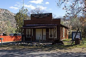
A replica of the 1868 courthouse was built in 1966 and serves as a museum today. The museum is open weekends April through September.
|
|
| Country | United States |
| State | California |
| County | Kern County |
| Elevation | 3,136 ft (956 m) |
| Reference #: | 100 |
Havilah is a small, unincorporated community in Kern County, California. This means it's a place where people live, but it doesn't have its own local government like a city or town. Havilah is nestled in the mountains between Walker Basin and the Kern River Valley. It's about 5 miles (8.0 km) south-southwest of Bodfish and sits at an elevation of 3,136 feet (956 m).
Contents
A Glimpse into Havilah's Past
The Gold Rush Era
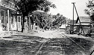
Havilah's story began in 1864 when a man named Asbury Harpending arrived in the area. He and his group discovered gold in Clear Creek, which flows into the Kern River. They decided to claim a spot for a town on the road connecting Keyesville to Tehachapi. They named their new town Havilah, a name from the Bible meaning "where there is gold."
By the end of 1865, Havilah was a busy boom town. A boom town is a place that grows very quickly because of a sudden increase in business, often due to a gold rush. Havilah had many businesses and nearly a thousand people, mostly miners.
Becoming a County Seat
When Kern County was officially formed on April 2, 1866, Havilah was chosen as the first county seat. A county seat is the main town where the county government offices are located. That same year, the county's first newspaper, the Havilah Courier, started publishing there. However, the county government later moved to Bakersfield in 1874.
Havilah also had its own post office from 1866 to 1918. The Havilah School District, started in 1866, was the very first public school in Kern County.
Nearby historic mining communities include Loraine and Twin Oaks. Today, Havilah is recognized as California Historical Landmark #100, marking its important place in California's history.
Havilah Today
Most of the original buildings in Havilah were destroyed by fires in the 1920s. So, not much remains from the early settlement, except for the Old Havilah Cemetery. However, a replica of the old courthouse and a one-room schoolhouse have been built near their original spots. If you drive along Caliente-Bodfish Road in Havilah, you'll see signs showing where other historic buildings once stood.

Havilah is easy to reach by car. It's just over 20 miles (32 km) from the intersection of State Route 58 and Caliente-Bodfish Road. It's also a short drive, just over five miles, from Bodfish on Caliente-Bodfish Road.
A US Forest Service fire station is located along Caliente-Bodfish Road. The area around Havilah also has several historic mines, including the Southern Cross Mine and the Friday Mine.
Understanding Havilah's Location
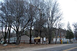
Havilah is surrounded by Sequoia National Forest lands to its east and west. It's located where Havilah Canyon and Haight Canyon meet. The ground in the canyon ranges from about 3,050 feet (930 m) to 3,400 feet (1,000 m) above sea level. The mountains on either side of the canyon are over 1,000 feet (300 m) higher than the road. King Solomons Ridge is to the east, and Hobo Ridge is to the west. Sometimes, snow can be seen here during the winter months.
The community is considered to be at a high risk for wildfires by the California Fire Alliance. Commercial electricity in Havilah is provided by Southern California Edison.
California Historical Landmark #100
The official marker for California Historical Landmark #100 tells us:
- NO. 100 HAVILAH - Gold deposits at Havilah were discovered in 1864. Havilah was the county seat between 1866, when Kern County was organized, and 1872, when the government was moved to Bakersfield. Havilah was an active mining center for more than 20 years, and there are still some operating mines in this vicinity.
You can find a state plaque for this landmark at 10 Miller St. in Bodfish, California. There's also a private plaque at 6789 Caliente-Bodfish Rd., Havilah, California.
 | DeHart Hubbard |
 | Wilma Rudolph |
 | Jesse Owens |
 | Jackie Joyner-Kersee |
 | Major Taylor |


