Quick facts for kids Head Lake |
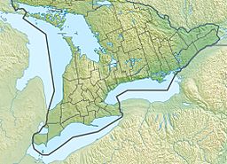
Location in Southern Ontario
|
| Location |
Kawartha Lakes, Ontario, Ontario |
| Coordinates |
44°44′25″N 78°54′46″W / 44.74028°N 78.91278°W / 44.74028; -78.91278 |
| Primary inflows |
Head River |
| Primary outflows |
Head River |
| Basin countries |
Canada |
|
| Max. length |
5 mi (8.0 km) |
| Max. width |
3 mi (4.8 km) |
| Max. depth |
30 feet (9 m) |
| Surface elevation |
879 feet (268 m) |
|
| Settlements |
Head Lake |
Head Lake is a beautiful lake located in the city of Kawartha Lakes, in the Canadian province of Ontario. It sits between the towns of Uphill to the west and Norland to the east. A road called Kawartha Lakes Road 45 (which used to be Highway 503) runs along the southern and western edges of the lake. The small community of Head Lake is also found on the southern shore.
About Head Lake
Head Lake is part of the larger Great Lakes Basin. This means its waters eventually flow into the Great Lakes. The lake is about 5 km (3.1 mi) wide and 8 km (5.0 mi) long. Its deepest point is about 30 feet (9 m) deep.
Water Flow
The main river that flows into Head Lake is the Head River. It enters the lake from the northeast side. The Head River also flows out of the lake from the northwest side. From there, the water travels through the Black River. It then joins the Severn River. Finally, all this water reaches Georgian Bay, which is part of Lake Huron.


